Drone Site Mapping
2D Orthomosaic
Georeferenced aerial maps for site planning, earthwork verification, and progress documentation. Available as a standalone service or add-on to progress monitoring packages.
High-Level Site Overviews
Without the Traditional Cost
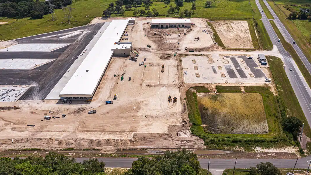
Our 2D orthomosaic mapping service gives site superintendents and project managers a georeferenced aerial view of their entire project in a single image. Unlike a traditional licensed land survey, drone mapping can be completed in hours and delivered the same day — making it ideal for periodic site checks, earthwork verification, and stakeholder reporting.
Available as a standalone service or as an add-on to our progress monitoring packages, site mapping is particularly valuable for large-scale projects in Marion County, Alachua County, and Sumter County where walking the full site perimeter is impractical.
Practical Applications for
Construction Site Managers
Site Overview & Planning
Get a bird's-eye view of your entire site in a single georeferenced image. Ideal for site superintendents managing large Marion or Sumter County projects who need a high-level overview without walking the full perimeter.
Earthwork Verification
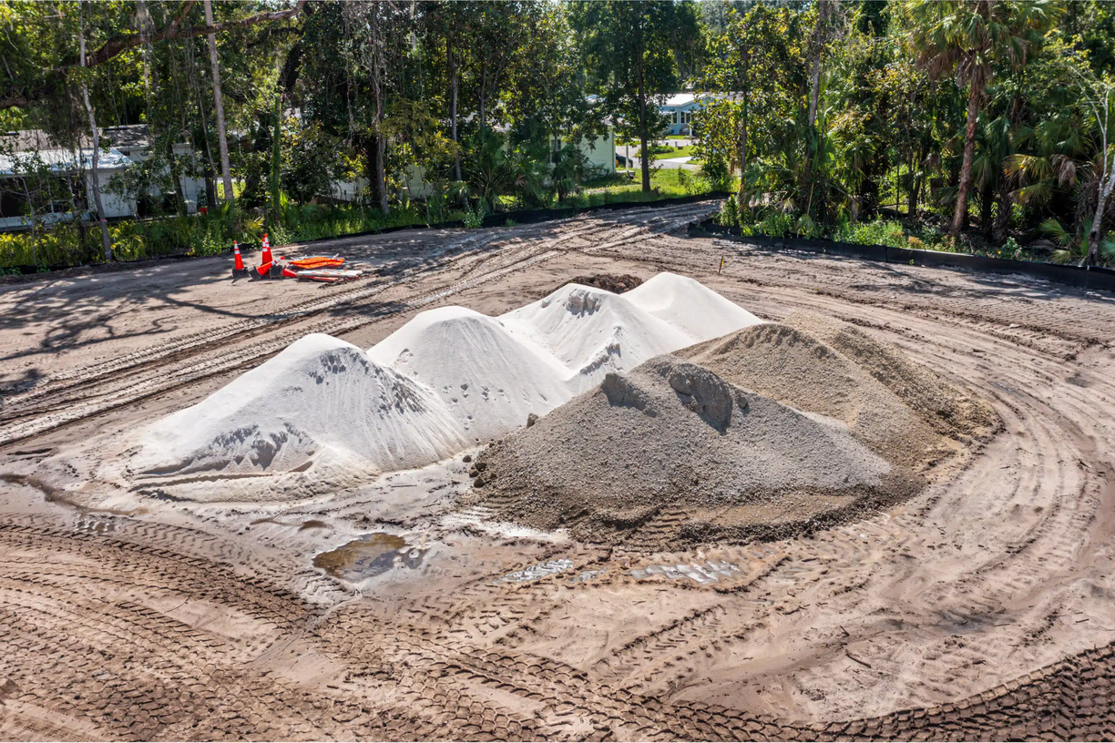
Use orthomosaic maps to verify grading progress, check fill and cut areas, and compare current site conditions against your civil drawings — without the cost of a traditional licensed survey crew.
Progress Documentation
Capture dated orthomosaic maps at key project milestones. Side-by-side comparisons show earthwork progress, utility installation, and site preparation in a format that's easy to share with stakeholders.
Boundary & Feature Identification
Identify site boundaries, access roads, drainage features, and existing structures from above. Useful for pre-construction planning and coordination with subcontractors before mobilization.
Choose the Right
Mapping Package
Single Map
One-time orthomosaic for a specific milestone or site condition review
- Single flight session
- 2D orthomosaic output
- Georeferenced GeoTIFF
- High-resolution export
- Delivered on your timeline
Mapping Bundle
Multiple maps across key project phases for ongoing site oversight
- 3 flight sessions
- 2D orthomosaic per session
- Georeferenced GeoTIFFs
- High-resolution exports
- Milestone scheduling
- Delivered on your timeline
Progress + Mapping
Combine weekly progress photography with periodic orthomosaic mapping
- Weekly progress photos/video
- Monthly orthomosaic map
- Georeferenced GeoTIFFs
- High-resolution exports
- Full project documentation
- Delivered on your timeline
All packages delivered on your timeline. Contact us to discuss your project scope and schedule.
When Project Managers
Order a Site Map
Earthwork Dispute
A subcontractor claims more fill was placed than the GC's records show. A dated orthomosaic from before and after the work provides a visual reference for resolution.
Pre-Pour Verification
Before a concrete pour, the superintendent needs to confirm subgrade elevations and drainage slopes are correct. A quick drone map provides a same-day visual check.
Lender Site Inspection
A construction lender requests a site overview for a draw request. An orthomosaic shows the full extent of work completed across the site in a single shareable image.
Subcontractor Coordination
Multiple subs are working across a large site. A current orthomosaic gives the PM a shared reference point for sequencing, access, and staging coordination.
Pre-Construction Baseline
Before clearing begins, a baseline orthomosaic documents existing site conditions — useful for disputes about pre-existing drainage issues or boundary encroachments.
Progress Reporting
Monthly orthomosaic maps provide a consistent visual record of site progress that can be included in owner reports alongside progress photos and video.
Works With Your
Existing Software
Our GeoTIFF outputs are compatible with the civil engineering and GIS platforms your team already uses.
Drone Site Mapping
FAQ
An orthomosaic is a high-resolution aerial image stitched together from dozens or hundreds of overlapping drone photos. Unlike a single aerial photo, an orthomosaic is geometrically corrected (orthorectified) so that distances and areas can be measured accurately across the entire image. The result is a georeferenced map you can overlay on your civil drawings or import into GIS software.
Our 2D orthomosaic maps typically achieve horizontal accuracy of 5–10 cm per pixel at standard flight altitudes, depending on site conditions and ground control point placement. This level of accuracy is suitable for site planning, earthwork verification, and progress documentation — but not a replacement for a licensed land surveyor when legal boundary accuracy is required.
We deliver georeferenced GeoTIFF files that can be imported into AutoCAD, Civil 3D, ArcGIS, QGIS, and most other civil engineering or GIS platforms. We can also provide KMZ files for Google Earth overlays and high-resolution JPEG exports for presentations and reports.
Yes. Site mapping is available as a standalone service or as an add-on to our progress monitoring packages. Combining mapping with regular progress photography is the most cost-effective approach for projects that need both visual documentation and periodic site overviews.
Using the DJI Mavic series, we can map sites up to approximately 100–200 acres per flight session depending on battery capacity and flight altitude. For larger sites, we schedule multiple flight sessions and stitch the outputs into a single seamless orthomosaic.
Yes. We provide drone site mapping throughout North Central Florida, including Marion County, Alachua County (Gainesville), Sumter County (Wildwood, The Villages), and surrounding areas. Contact us to discuss your project location.
Need a Site Map for
Your Next Project?
Get a free quote for drone site mapping in Ocala, Gainesville, Wildwood, or anywhere in North Central Florida.
Drone Site Mapping Available Near You
Site Mapping in Ocala
2D orthomosaic mapping for Marion County earthwork and grading projects.
Site Mapping in Gainesville
Alachua County site mapping for UF-area and university corridor development.
Site Mapping in Wildwood
I-75 corridor and Sumter County orthomosaic mapping services.
Site Mapping in Belleview
South Marion County site mapping for rural and residential development.
Site Mapping in The Villages
Sumter County orthomosaic mapping for community expansion projects.
Site Mapping in Spring Hill
Hernando County SR-52 corridor orthomosaic and earthwork mapping.
Site Mapping in Crystal River
Citrus County coastal and industrial site mapping services.
Site Mapping in Leesburg
Lake County US-27 corridor orthomosaic mapping for development projects.
Site Mapping in Clermont
Lake County Wellness Way corridor site mapping and earthwork verification.
Site Mapping in Brooksville
Hernando County civic and commercial site mapping services.
Site Mapping in Dunnellon
Marion/Levy border orthomosaic mapping for active development projects.
Site Mapping in Newberry
Alachua County I-75 corridor site mapping and progress documentation.
Site Mapping in Lady Lake
Lake County Villages-adjacent site mapping for subdivision development.