Aerial Photography
for Construction
20-megapixel aerial stills for construction sites, commercial developments, and real estate projects across Ocala, Gainesville, and North Central Florida.
Professional Aerial Imagery
Ready for Commercial Use
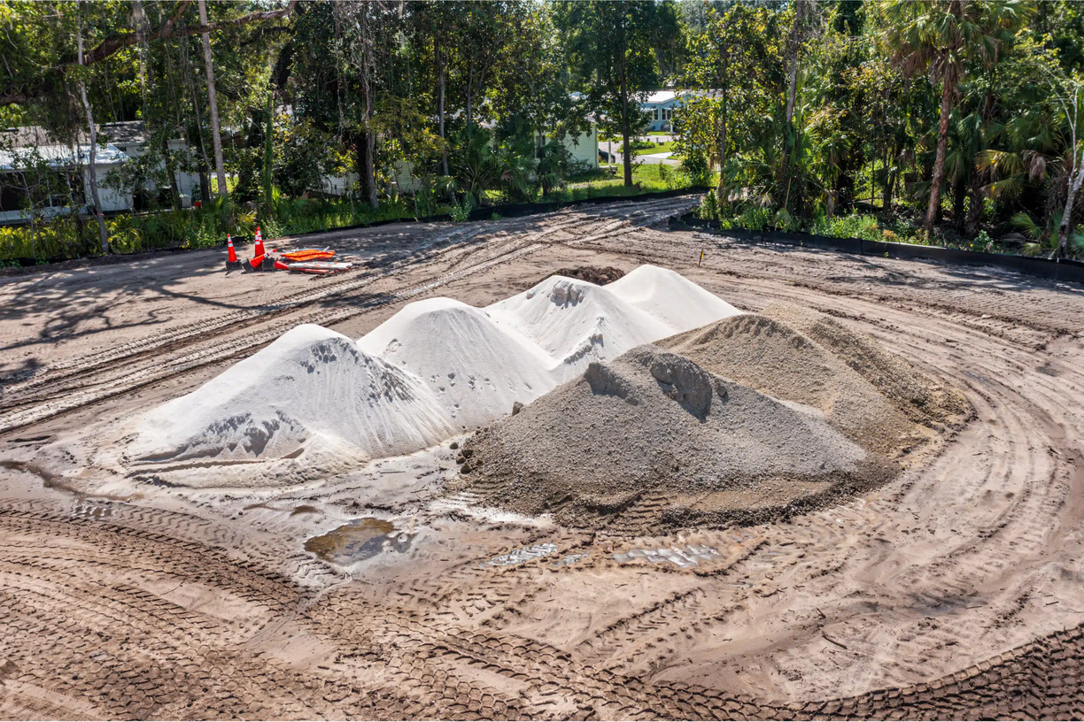
Every aerial photography session delivers a complete set of high-resolution stills captured from multiple angles and altitudes. Images are organized, labeled, and delivered on your timeline — ready for immediate use in marketing materials, investor presentations, or project documentation.
- 20-megapixel aerial stills in full resolution
- Multiple angles and altitudes per site
- Nadir (straight-down) and oblique perspectives
- Licensed for commercial use — marketing, print, web
- Organized by date and area for easy reference
- Delivered on your timeline — we'll meet any deadline
Aerial Photography
Use Cases
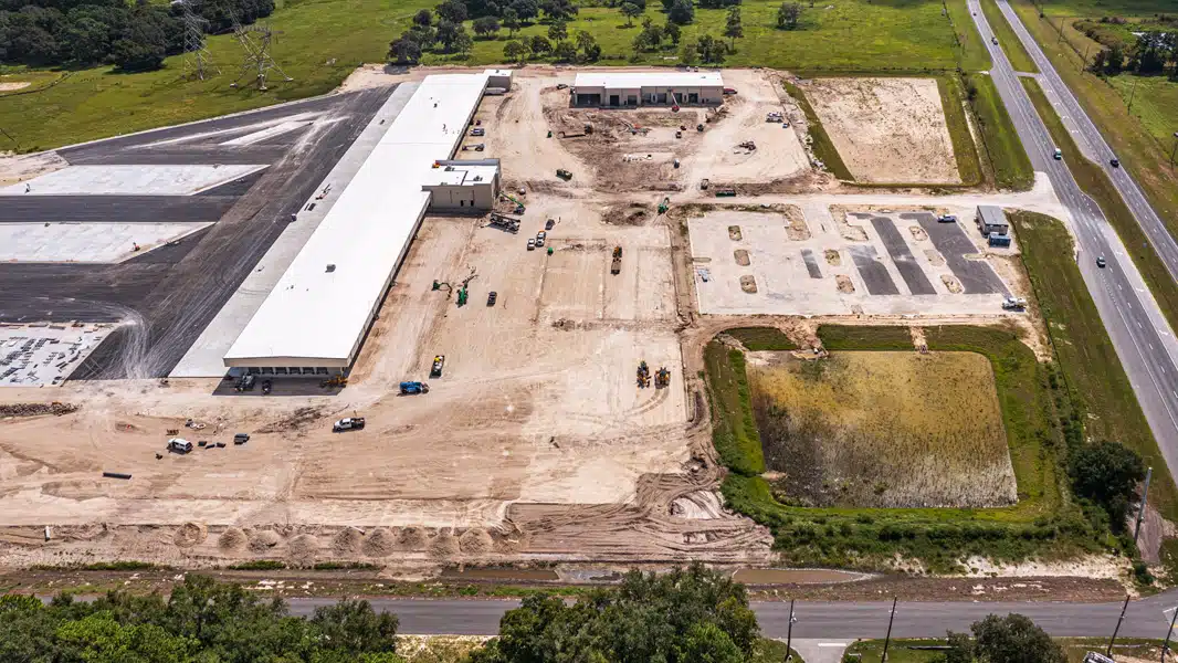
Commercial Development
Capture the scale and scope of commercial projects along the I-75 corridor, SR-200, and throughout Marion County. High-resolution aerials for investor decks, lender updates, and project marketing.
Residential Construction
Document residential subdivisions, custom home builds, and community developments from above. Provide homebuyers and HOA boards with compelling aerial imagery of their future neighborhood.
Project Bidding & Proposals
Win more bids with professional aerial photography that demonstrates your firm's capabilities and showcases completed projects. High-quality imagery signals professionalism and attention to detail.
Investor & Stakeholder Reporting
Replace written progress reports with compelling aerial imagery that shows exactly what has been built. Out-of-state investors and lenders can see the project clearly without a site visit.
Drone Photography vs. Traditional Photography
| Factor | Drone Aerial | Ground-Level |
|---|---|---|
| Full site coverage in one session | ✓ | ✕ |
| Captures scale & scope of project | ✓ | ✕ |
| Shows site context & surroundings | ✓ | ✕ |
| Suitable for investor presentations | ✓ | Limited |
| Reveals drainage & grading issues | ✓ | ✕ |
| No scaffolding or lift required | ✓ | ✕ |
| FAA compliant for commercial use | ✓ | N/A |
The aerial photos from 352 Drone Services are the first thing I put in every bid package now. We've won three contracts this year where the client specifically mentioned the quality of our project photos. It's a small investment that pays for itself in the first bid.
General Contractor
Commercial Builder — Marion County, FL
Aerial Photography
Packages
Single Session
One-time project documentation
Best for: Bid packages, project completions, or investor updates.
- Full site coverage — multiple angles
- 20MP aerial stills in full resolution
- Nadir + oblique perspectives
- Commercial use license included
- Delivered on your timeline
Milestone Package
3 visits at key project phases
Best for: GCs who need documentation at pre-pour, framing, and substantial completion.
- 3 scheduled site visits
- 20MP aerial stills per visit
- Priority scheduling
- Commercial use license included
- Organized by phase for easy reference
Marketing Bundle
Photography + video for marketing
Best for: Developers who need a complete media package for marketing and investor presentations.
- Full aerial photography session
- 4K video walkthrough included
- Edited highlight reel
- Commercial use license
- Priority delivery
Custom packages available. Contact us to discuss your project.
Pair Aerial Photography With
Construction Progress Monitoring →
Add scheduled weekly or monthly visits to build a complete visual record of your project from groundbreaking to completion.
4K Video Production →
Combine aerial stills with cinematic 4K drone video for a complete media package for marketing and stakeholder presentations.
Aerial Photography FAQ
Commercial aerial photography uses FAA-certified drone pilots to capture high-resolution still images of construction sites, commercial properties, and development projects from above. The resulting imagery is used for project marketing, investor reporting, bid packages, and stakeholder communications. Unlike ground-level photography, aerial imagery captures the full scope and scale of a project in a single frame.
We capture 20-megapixel aerial stills using professional DJI Mavic-series drones. This resolution is sufficient for large-format printing, detailed digital review, and high-quality marketing materials. Images are delivered in full resolution with no compression.
Yes. We provide aerial photography services throughout North Central Florida including Marion County (Ocala, Belleview, Dunnellon), Alachua County (Gainesville, Newberry), and Sumter County (Wildwood, The Villages). Contact us to confirm coverage for your specific project location.
Most construction site aerial photography sessions take 30–90 minutes on-site depending on project size. We capture systematic coverage of the entire site plus close-up documentation of specified areas. Larger sites or multi-building developments may require longer sessions.
Yes. All deliverables include a commercial use license covering marketing materials, websites, social media, print advertising, investor presentations, and public relations. There are no additional licensing fees for standard commercial use.
Yes. We carry $2M+ commercial aviation liability insurance and our pilots hold FAA Part 107 Remote Pilot Certificates. Certificates of insurance are available upon request for your project records or general contractor requirements.
For construction and development marketing, aerial photography is often more impactful than ground-level photography because it shows the full scope of the project, the site context, and the surrounding area. For most GC and developer marketing needs — bid packages, investor decks, project websites, and social media — aerial imagery alone is sufficient. We can also pair aerial stills with 4K video for a complete media package.
All deliverables are uploaded to a shared Google Drive or Dropbox folder after each session. You can forward the link directly to your owner, investor, or lender — no login or special software required. Folders are organized by date and area for easy reference.
Yes. We coordinate with your site superintendent to identify a safe flight window — typically during a natural break or at end of day. FAA Part 107 rules require safe separation from personnel, and our pilots are experienced at navigating active job sites professionally without disrupting work.
Aerial photography captures high-resolution stills for visual documentation, marketing, and reporting. Aerial mapping (orthomosaic or 2D mapping) processes overlapping images into a georeferenced top-down map used for measurements, earthwork estimates, and site planning. We offer both services — photography for visual documentation and supplemental mapping as an add-on for site superintendents who need measurement-grade overviews.
Ready for Professional Aerial Photography?
Get a free quote for aerial photography in Ocala, Gainesville, Wildwood, and throughout North Central Florida.
Get a Free QuoteAerial Photography Available Near You
Aerial Photography in Ocala
High-resolution aerial stills for Marion County construction and development projects.
Aerial Photography in Gainesville
Serving UF-area and Alachua County construction and commercial sites.
Aerial Photography in Wildwood
I-75 corridor and Sumter County aerial photography coverage.
Aerial Photography in Belleview
South Marion County equestrian, rural, and residential aerial photography.
Aerial Photography in The Villages
Sumter County community and commercial development aerial coverage.
Aerial Photography in Spring Hill
Hernando County SR-52 corridor and Suncoast Pkwy growth area.
Aerial Photography in Crystal River
Citrus County coastal industrial and residential project photography.
Aerial Photography in Leesburg
Lake County US-27 corridor and Villages spillover development.
Aerial Photography in Clermont
Lake County's fastest-growing city — Wellness Way corridor.
Aerial Photography in Brooksville
Hernando County seat commercial and civic project photography.
Aerial Photography in Dunnellon
Marion/Levy border — active development aerial documentation.
Aerial Photography in Newberry
Alachua County I-75 corridor fast-growing community.
Aerial Photography in Lady Lake
Lake County Villages-adjacent active subdivision development.