67 Consecutive Weeks of
Aerial Progress Documentation
Ben E. Keith Distribution Center
Weekly drone flights — high-resolution photography, 4K video, and orthomosaic mapping — delivered every Friday midday without exception across a 707,000-square-foot industrial build on the I-75 corridor in Alachua, Florida.
North Central Florida's Largest
Active Distribution Center Build
Ben E. Keith Foods — one of the largest food and beverage distributors in the United States — selected Alachua, Florida as the site for a major regional distribution hub following its 2022 acquisition of Florida Food Service. The resulting facility, located within the Progress Park industrial corridor near the I-75 and I-10 interchange in Alachua, FL, spans between 707,000 and 724,000 square feet across a 148-acre site. When fully operational, the facility is projected to generate approximately 400 jobs and extend Ben E. Keith's distribution reach across the Southeastern region to Charleston, South Carolina.
Groundbreaking occurred in early 2025, with operational completion targeted for fall 2026. The structural scope includes 105 dock doors, tilt-wall panel construction, and paved staging areas engineered to accommodate 120 tractor-trailers simultaneously.
352 Construction Drone Services was engaged to provide recurring aerial progress documentation beginning with the first site preparation activities in March 2025. The engagement has continued without interruption through Visit 67 in July 2026, producing a continuous chronological record of every major construction phase from initial earthwork through the final stages of envelope enclosure and site completion.
Project Specifications
| Client | Ben E. Keith Foods |
| Location | Alachua, FL 32615 |
| Facility Size | 707,000 – 724,000 sq ft |
| Site Footprint | 148 acres |
| Dock Doors | 105 |
| Tractor-Trailer Capacity | 120 simultaneous |
| Groundbreaking | Early 2025 |
| Target Completion | Fall 2026 |
| Documentation Scope | 67 consecutive weekly visits |
| Deliverables Per Visit | Photography · 4K Video · Orthomosaic |
| Delivery Schedule | Every Friday, midday |
Scrub Through 67 Weeks of
Aerial Progress Documentation
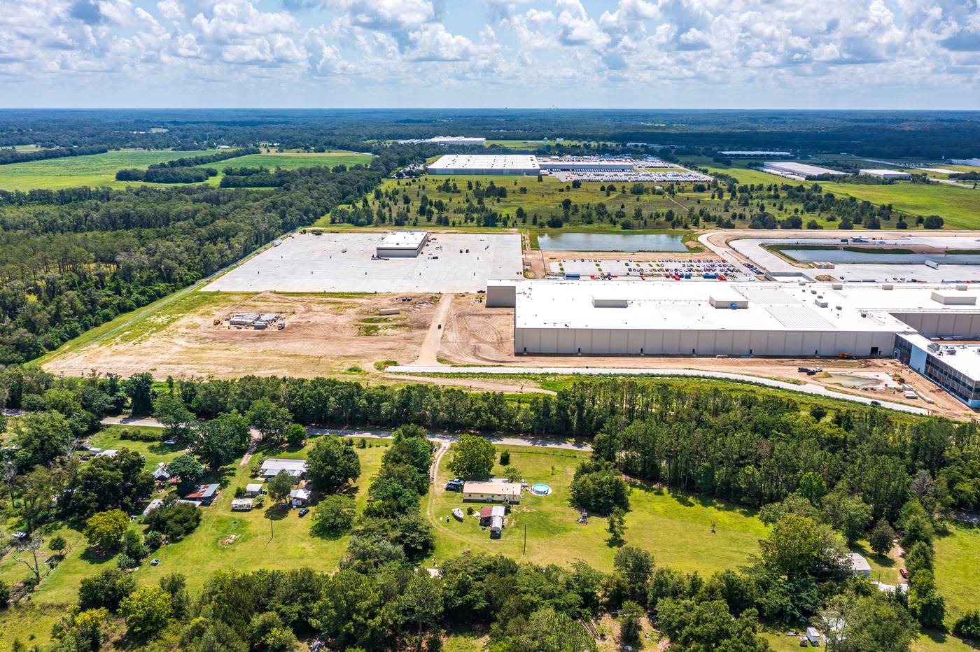
Drag the slider to move through the chronological aerial documentation of the Ben E. Keith distribution center — from initial site clearing through structural steel, tilt-wall erection, and envelope enclosure. Every image represents a real weekly flight.
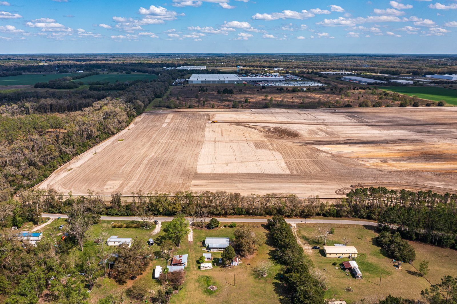
The continuous nature of this dataset — 67 visits spanning March 2025 through July 2026 — provides the Ben E. Keith project ownership with an objective, date-indexed visual record of every construction phase. This archive supports lender draw requests, subcontractor pay application validation, schedule delay documentation, and long-term facility management planning. Weekly drone site overviews for project management at this scale are not a luxury; they are a risk management tool.
Week 1 vs. Today
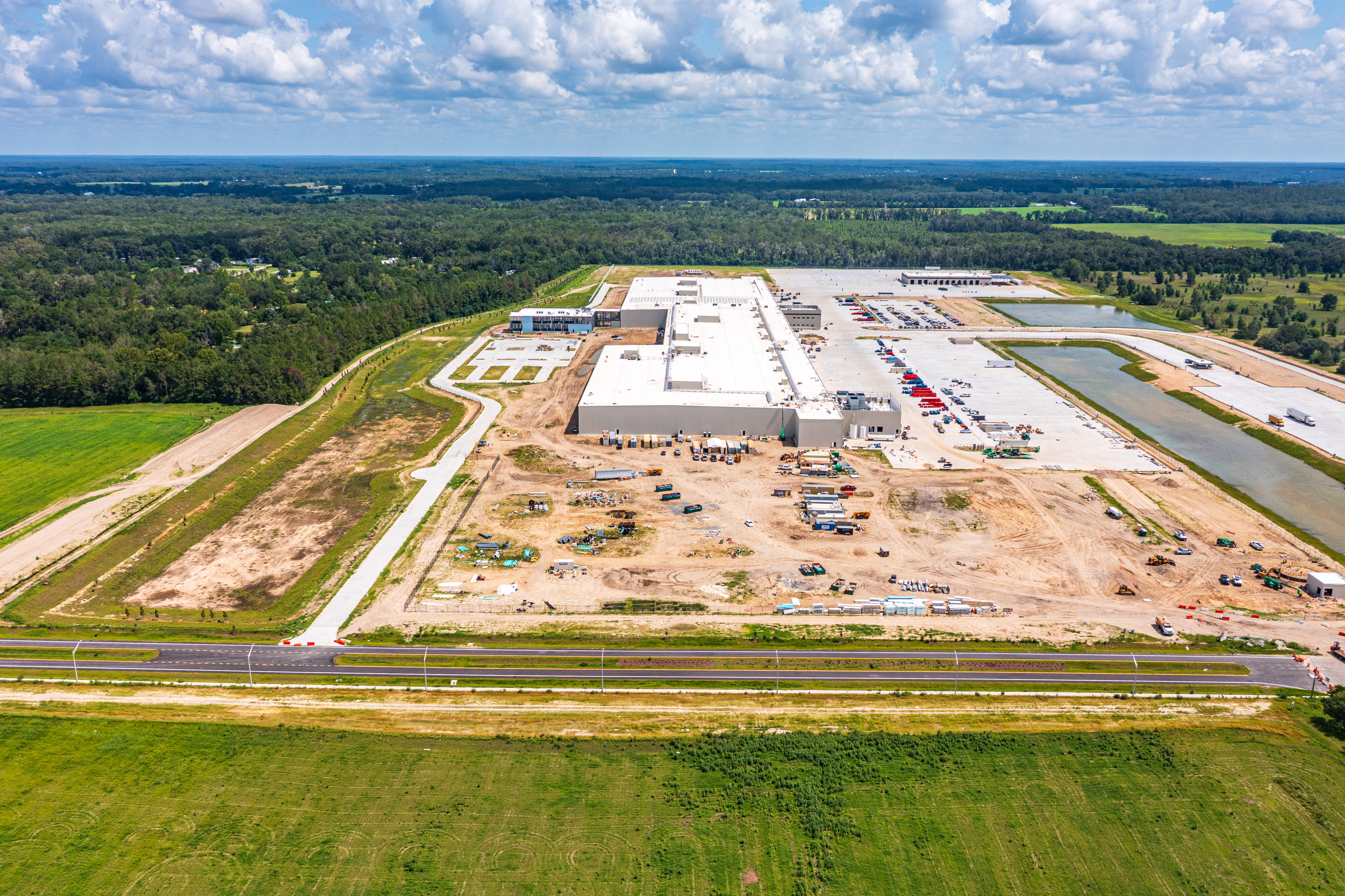
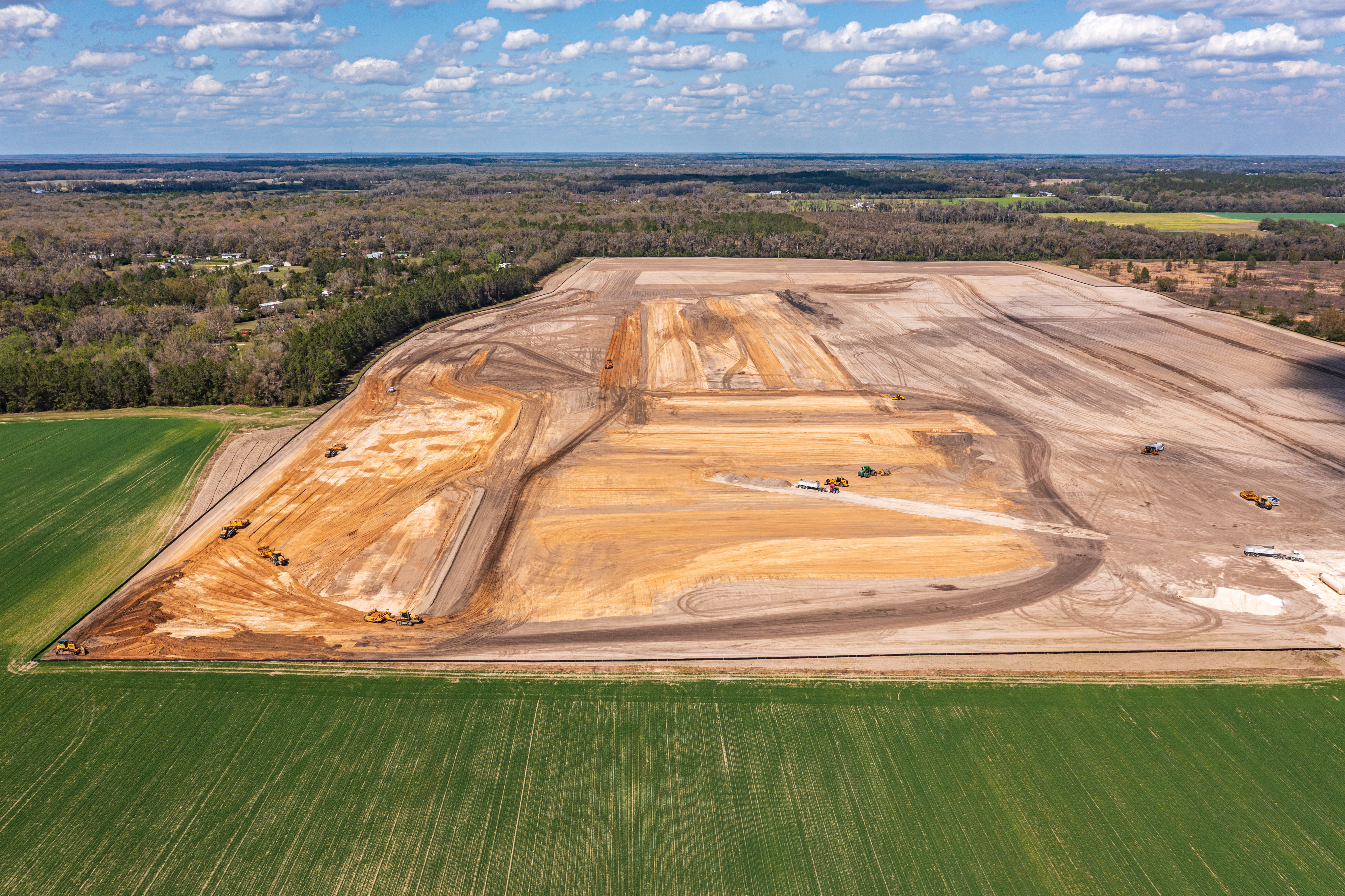
Grab the handle and compare the first week of documentation against the most recent flight. The chronological aerial documentation of structural milestones in between — foundations, steel, envelope, paving — is all in the weekly archive above.
Five Construction Phases,
Zero Documentation Gaps
Earthwork & Site Preparation
The 148-acre site required extensive cut-and-fill operations, surface grading, and temporary access road establishment. Aerial data collection for cut-and-fill analysis during this phase allowed the civil engineering team to verify excavation progress, monitor finished elevations, and ensure proper stormwater drainage slope development against the approved engineering plans. Orthomosaic maps provided measurable spatial data for aggregate stockpile volumetric tracking without requiring ground-based crews.
Foundation & Subsurface Infrastructure
Underground utilities — deep water lines, sanitary sewer systems, storm drainage networks, and electrical conduits — are permanently concealed once backfilling occurs. The weekly photo archive from this phase provides an irreplaceable pre-pour and pre-backfill visual record. High-resolution aerial photography documented concrete footing preparation, floor slab reinforcement, and foundation wall construction, establishing an objective quality assurance record that can be referenced for the life of the facility.
Tilt-Wall Erection & Structural Steel
Modern industrial warehouses of this scale are typically constructed using tilt-wall concrete panels — large concrete slabs cast on the floor slab and tilted into vertical position by crane. The drone documentation from this phase captured the sequential tilt of each panel section and the progressive erection of the structural steel framework. As-built visual verification of tilt-wall panels prior to the final interior build-out phase provided the project team with a permanent record of panel placement and bracing. This phase concluded with the January 13, 2026 topping-out ceremony.
Envelope Enclosure & Roofing
Once the structural steel was topped out and the tilt-wall panels braced, the building envelope was sealed to protect the interior. Drone documentation during this phase verified the installation of rooftop HVAC units, skylights, and weatherproofing membranes from above — providing roof inspection data without exposing workers to fall hazards. The chronological archive from this phase visually demonstrates the transition from a skeletal steel frame to a fully enclosed 707,000-square-foot secure distribution hub.
Paving, Flatwork & Site Completion
The final phase documents the extensive exterior concrete and asphalt paving — the 105 dock door approaches, the massive tractor-trailer staging and parking areas, and the final site grading. The concluding drone flights provide definitive as-built visual verification of the completed facility, which will serve as a long-term property management and facility maintenance asset for Ben E. Keith Foods. I-75 corridor warehouse aerial progress tracking across this final phase confirms the facility's readiness for operational turnover.
January 13 Topping-Out Ceremony
The topping-out ceremony on January 13, 2026 marked the placement of the final structural steel beam on the Ben E. Keith distribution center and celebrated 160 consecutive incident-free days on the construction site. The traditional Arizona pine tree was placed atop the highest beam. The drone documentation from Visit 43 captured the ceremony from multiple aerial vantage points, providing a permanent record of this structural and cultural milestone for Ben E. Keith Foods and the project ownership team.
Weekly Progress Gallery
All 62 Documented Visits
The gallery below represents the complete set of 62 documented visits available in this archive (visits 8, 32, 33, 35, and 44 are not represented in the current dataset). Each thumbnail links to the full-resolution representative image for that visit. Visits marked "ORTHO" include a corresponding orthomosaic map captured during that flight. The chronological sequence of this North Central Florida distribution center aerial mapping archive spans from initial site clearing in March 2025 through the final completion phase in July 2026.
What Is an Orthomosaic
& Why Does It Matter?
An orthomosaic is a geometrically corrected aerial image produced by stitching hundreds of overlapping drone photographs into a single, spatially accurate top-down view of the site. Unlike a standard aerial photograph — which distorts scale and geometry due to camera angle and terrain variation — an orthomosaic is orthorectified: every pixel is corrected to represent a true, measurable ground position. This makes it a functional spatial dataset, not just a photograph.
For the Ben E. Keith distribution center, industrial warehouse orthomosaic mapping deliverables were produced at key intervals throughout the 67-week engagement. Civil engineers and site superintendents used these maps to verify earthwork progress against approved grading plans, measure the extent of concrete flatwork placement, and confirm the positioning of dock door approaches relative to the design layout — all without requiring a physical site visit to the 148-acre Alachua property.
The orthomosaic data also supports objective pay application validation. When a subcontractor submits a pay app claiming a specific percentage of completion on site grading or paving, the corresponding orthomosaic provides a spatially accurate, date-stamped basis for verifying or disputing that claim. This capability is particularly valuable on a project of this scale, where earthwork and paving subcontractors are working across dozens of acres simultaneously.
Orthomosaic data can be exported as a GeoTIFF for ingestion into GIS platforms, overlaid on design drawings in Procore or Autodesk Construction Cloud, or used directly as a reference layer for site logistics planning. The full-resolution original TIF files for each orthomosaic flight are archived alongside the compressed JPG deliverables.
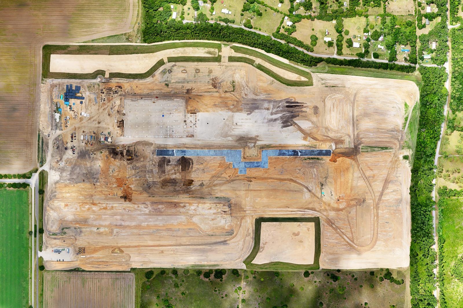
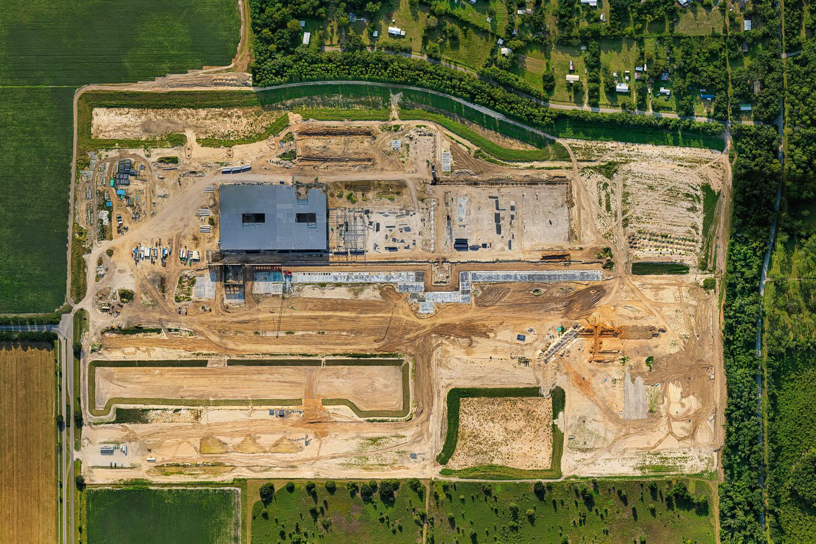
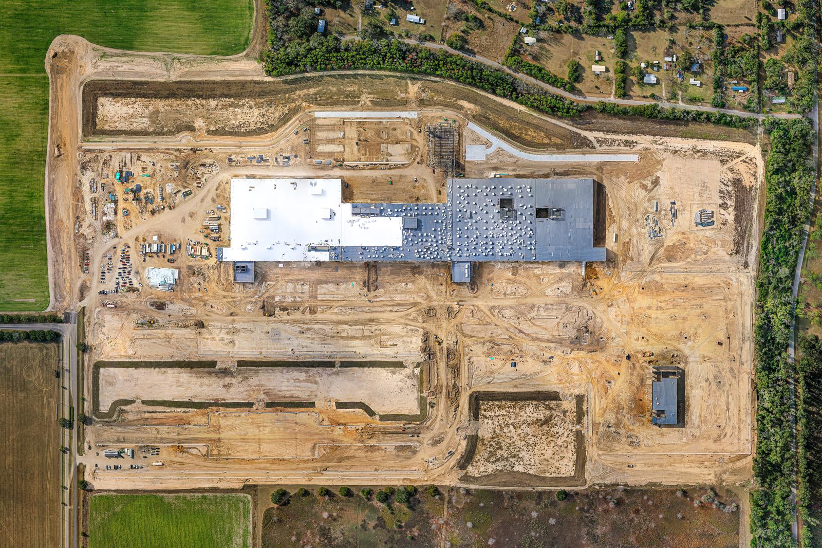
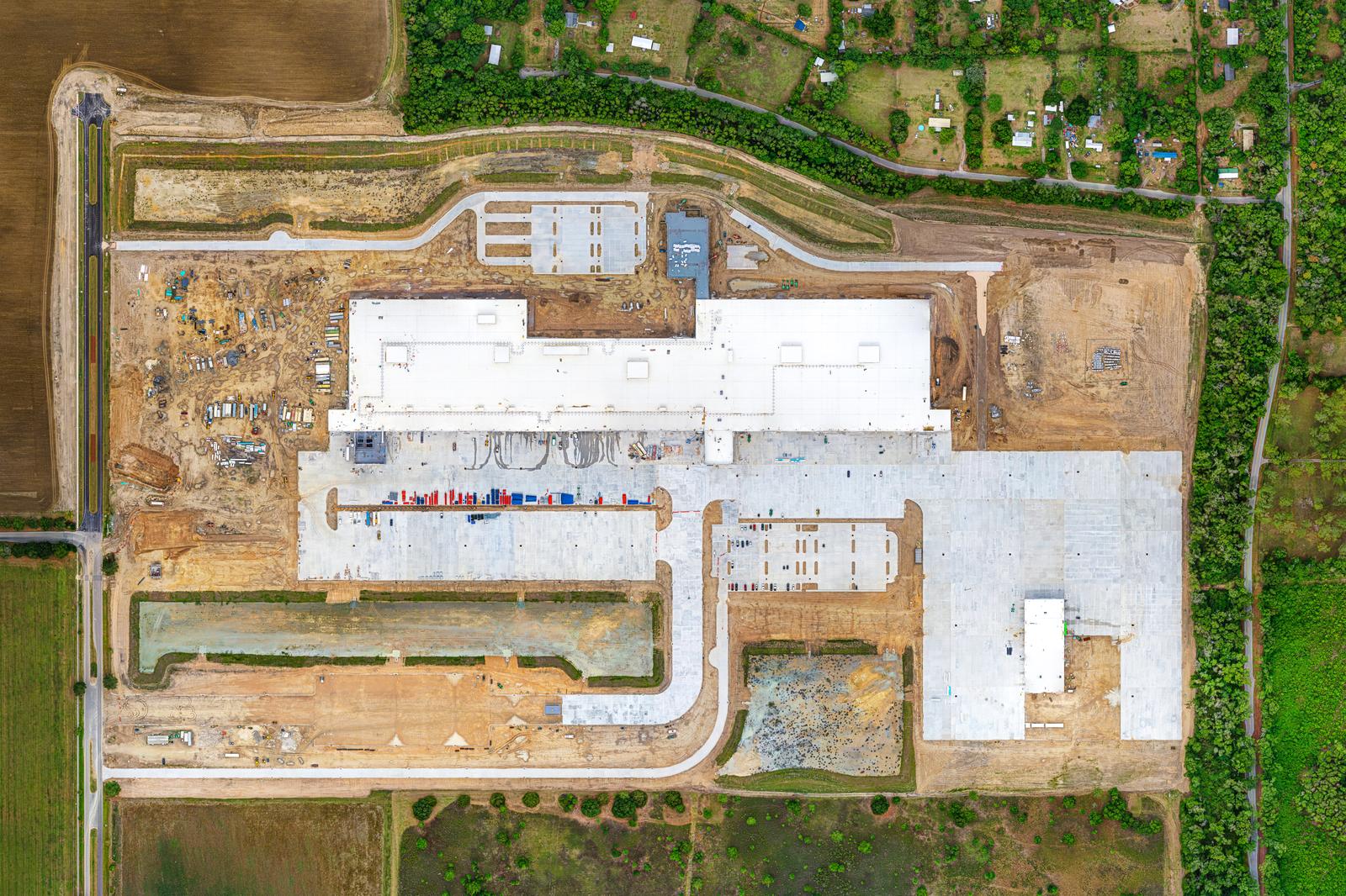
Sample orthomosaic maps from the Ben E. Keith documentation archive. 12 orthomosaic flights were conducted across the 67-week engagement.
4K Aerial Video Walkthroughs
Delivered Every Friday Midday
Every weekly visit produced multiple 4K video clips: a combined site overview, a criss-cross flyover for full-site coverage, a lookaround from a fixed altitude, and a dedicated flyover pass. The video below is a representative sample from the 67-week archive.
Combined Site Overview
Full-site flyover capturing all active work zones in a single continuous pass. Used for weekly OAC meeting construction progress updates.
Criss-Cross Coverage
Systematic grid pattern ensuring complete aerial data collection across the 148-acre footprint. Provides consistent overlap for orthomosaic processing.
Lookaround & Flyover
Altitude-fixed lookaround and dedicated flyover pass for perspective context. Useful for drone video clips for site logistics planning and stakeholder presentations.
The Same Shot,
Every Single Week
Every flight at the Ben E. Keith site is executed using pre-programmed GPS waypoints — the same altitude, the same headings, the same camera angles, repeated with sub-meter accuracy on every visit. This isn't incidental; it's the foundation of what makes the 67-week archive genuinely useful as a construction record rather than just a collection of aerial photos.
When a project manager, lender, or subcontractor needs to compare progress between two dates — say, the state of the dock door approaches on March 5 versus April 9 — they are looking at images captured from identical positions. The site changed; the camera position did not. That consistency eliminates the visual ambiguity that comes from ad-hoc drone flights where the operator picks a different angle each time, and it makes side-by-side comparisons immediately legible without any spatial interpretation.
The same principle applies to the orthomosaic flights: each mapping mission follows the same grid pattern and altitude, ensuring that successive orthomosaics can be overlaid directly in GIS software or Procore for accurate change detection and earthwork volume comparisons across the project timeline.
Flight paths are saved and replicated on every visit — same altitude, same headings, same camera angles. Sub-meter repeatability across 67 consecutive flights.
Because the drone flies the same positions each visit, any two photos from the archive can be placed side-by-side for direct visual comparison without spatial ambiguity.
Successive orthomosaics follow the same grid pattern and GSD, allowing direct overlay in GIS or Procore for change detection and earthwork volume comparisons.
Consistent framing means the archive holds up as objective documentation in lender draw reviews, pay application disputes, and schedule delay claims — not just as marketing material.
67 Visits. 67 Deliveries.
Zero Missed Weeks.
The Ben E. Keith engagement has operated on a consistent weekly schedule from March 2025 through July 2026 — through Florida summer heat, holiday periods, and weather disruptions. Every single visit has produced a complete deliverable package, and every package has been delivered to the project team by midday Friday of the flight week.
Every scheduled visit produced a complete deliverable package — photography, video, and orthomosaic where applicable. No partial deliveries, no missed weeks.
All 67 deliverable packages were delivered to the project team by midday Friday of the flight week, supporting the project's weekly OAC reporting cycle.
The engagement has spanned 16 months of active construction — from initial site clearing through the final completion phase — without a single documentation gap.
For general contractors, developers, and lenders managing multi-year industrial builds, the reliability of the documentation provider is not a secondary consideration — it is the primary one. A single missed week during a critical phase (a pre-pour inspection, a tilt-wall erection sequence, a utility installation before backfill) produces a permanent gap in the project record that cannot be retroactively filled. The Ben E. Keith engagement demonstrates that 352 Construction Drone Services maintains the operational consistency required for long-term construction progress monitoring timeline commitments.
Frequently Asked Questions
Every weekly visit to the Ben E. Keith Alachua construction site produced three distinct deliverable types: a full high-resolution photo set captured from multiple vantage points across the 148-acre site, a 4K video walkthrough documenting that week's site conditions and active work zones, and — on designated mapping flights — a georeferenced orthomosaic map of the facility footprint. All deliverables were packaged and delivered to the project team by midday Friday of the flight week, without exception across all 67 visits.
Commercial construction financing on a project of this scale — a 707,000-square-foot distribution center — is typically disbursed in tranches tied to verified milestone completion. Lenders and their inspectors require objective, date-stamped evidence that work-in-place matches the draw request before releasing funds. The weekly aerial documentation archive provides exactly this: a continuous, timestamped visual record that allows a lender's inspector to verify the percentage of structural steel erected, concrete flatwork poured, or dock door framing completed without requiring a physical site visit to Alachua. This accelerates the draw approval cycle and reduces the administrative burden on the project management team.
An orthomosaic is a geometrically corrected aerial image assembled from hundreds of overlapping drone photographs, producing a single high-resolution, spatially accurate top-down view of the site. Unlike a standard aerial photo, an orthomosaic is scaled and measurable — a project manager or civil engineer can take accurate distance and area measurements directly from the image. For a 148-acre site with 105 dock door approaches, extensive paved staging areas, and large-scale earthwork operations, orthomosaic data provides a reliable basis for verifying grading progress, monitoring paving coverage, and comparing current site conditions against the approved civil engineering plans.
On large industrial projects, subcontractor pay applications frequently claim a percentage of completion that differs from what the general contractor observes in the field. The weekly orthomosaic and photo archive provides an objective, date-indexed record of site conditions at the time each pay app period closes. If an earthwork subcontractor claims 80% completion on site grading and fill placement, the corresponding week's orthomosaic can be used to visually and spatially validate or dispute that claim, reducing the time spent on back-and-forth negotiations and providing a defensible record if a dispute escalates.
The topping-out ceremony on January 13, 2026 — documented during Visit 43 — marked the placement of the final structural steel beam on the Ben E. Keith distribution center. The event also celebrated 160 consecutive incident-free days on the construction site, a significant safety milestone for a project of this complexity and scale. The traditional Arizona pine tree was placed atop the highest beam. The drone documentation from Visit 43 captured the ceremony from multiple aerial vantage points, providing a permanent visual record of this structural milestone for Ben E. Keith Foods and the project ownership team.
The value of longitudinal aerial progress documentation compounds over time. A single flight produces a snapshot; 67 consecutive weekly flights produce an objective, chronological historical record of every major construction phase — from the initial 148-acre site clearing through foundation pours, tilt-wall erection, structural steel, envelope enclosure, and final paving. This continuous archive is irreplaceable: once a phase is buried under concrete or enclosed behind walls, the only way to verify what happened is through the documentation captured during that phase. On-demand flights miss this window. Weekly consistency ensures no critical milestone — a utility trench before backfill, a pre-pour reinforcement inspection, a grading verification — is ever undocumented.
Yes. All commercial drone operations conducted by 352 Construction Drone Services are performed under FAA Part 107 certification. The Alachua construction site falls within the general airspace of the Gainesville Regional Airport (GNV) Class D airspace boundary, which required LAANC (Low Altitude Authorization and Notification Capability) authorization for each flight. All 67 visits were conducted in full FAA compliance. Additionally, 352 Construction Drone Services carries aviation-specific liability insurance coverage appropriate for commercial operations over active construction sites.
Yes. The Ben E. Keith engagement represents the type of long-term, recurring aerial progress documentation that 352 Construction Drone Services is specifically structured to provide. We serve general contractors, developers, and facility owners managing industrial warehouse construction, distribution center builds, and large-scale commercial projects throughout the I-75 and I-10 corridors in Alachua, Marion, Sumter, Hernando, and Citrus counties. If your project requires consistent weekly or bi-weekly aerial data collection for stakeholder reporting, lender draw support, or pay application validation, contact us to discuss a recurring documentation schedule.
Your Project Deserves the Same
Level of Documentation
Whether you are managing a 50,000-square-foot tilt-wall warehouse or a 700,000-square-foot regional distribution center, a consistent weekly aerial documentation program protects your project record, supports your lender relationships, and provides your project management team with objective site visibility from groundbreaking through turnover. We serve general contractors, developers, and facility owners throughout North Central Florida's I-75 and I-10 industrial corridors.