Construction Progress Monitoring by Drone in North Central Florida
Built for project managers who need reliable, scheduled aerial documentation without adding another task to their plate. We fly your site on your schedule, deliver organized photo and video packages on your timeline, and keep a complete visual record of your project from groundbreaking to closeout. Serving Ocala, Gainesville, Wildwood, and all of North Central Florida.
Your Project, Documented
From Every Angle
Construction progress monitoring is a scheduled aerial documentation service. Our FAA Part 107 certified pilots visit your site on a regular cadence — weekly, bi-weekly, or monthly — and capture systematic high-resolution photography and 4K video of the entire project.
The result is a time-stamped visual record of your project's evolution that project managers, owners, lenders, and investors can review from anywhere — without a site visit.
For project managers specifically, this means one fewer thing on your plate: no more compiling job site photos after a walk, no more fielding calls from owners asking for updates, and no more relying on memory or crew photos if a dispute arises.
Progress monitoring pairs naturally with our site mapping service for volumetric and grading verification, and with pre-construction documentation to establish baseline conditions before work begins.
Six Reasons PMs Use
Aerial Progress Monitoring
Remote Site Visibility
Give out-of-state owners, investors, and executive stakeholders a real-time view of site progress without requiring a physical visit. Reduce unnecessary travel and keep decision-makers informed on schedule.
Dispute-Proof Documentation
Timestamped aerial records create an indisputable visual log of site conditions at every stage. Protect your firm from subcontractor disputes, scope-of-work disagreements, and insurance claims with photographic evidence.
Schedule & Milestone Tracking
Compare aerial imagery across visits to identify schedule slippage early. Spot delays in earthwork, foundation, framing, or MEP rough-in before they compound into costly overruns.
Early Issue Detection
Aerial perspective reveals site conditions that ground-level walkthroughs miss — drainage pooling, material staging problems, safety hazards, and encroachment issues are visible from above before they escalate.
Stakeholder Reporting
Deliver polished progress reports to owners, lenders, and investors on a consistent schedule. Aerial imagery and video dramatically improve the quality of owner meetings and investor updates.
Cost-Effective Documentation
A single drone visit costs a fraction of a site visit by an owner's rep or project executive. For projects with out-of-area stakeholders, aerial monitoring pays for itself by eliminating unnecessary travel.
How Construction Progress
Monitoring Works
Initial Consultation
We review your project scope, schedule milestones, and deliverable requirements. We identify any airspace considerations (airports, restricted zones) and confirm the flight plan.
Flight Scheduling
We coordinate with your superintendent to schedule visits around key milestones — pre-pour, framing completion, roofing, MEP rough-in, or any phase your stakeholders need documented.
On-Site Operations
Our FAA Part 107 certified pilot arrives on schedule, conducts a safety briefing, and executes the flight plan. We capture systematic coverage of the entire site plus close-up documentation of specified areas.
Delivery & Reporting
High-resolution stills and 4K video are delivered on your timeline — we'll meet any deadline you have. Files are organized by date and area for easy reference. We can also produce edited highlight reels for owner meetings.
Exactly What Gets
Delivered to You
Every progress monitoring visit results in a complete, organized deliverable package sent directly to your inbox. Here is exactly what you receive after each flight:
High-Resolution Photos
A full set of high-resolution still images (minimum 20MP) in JPEG format, organized by flight date and site zone. Images are geotagged and timestamped. Typical delivery includes 40–80 images per visit depending on site size and complexity.
4K Video Walkthrough
A smooth, edited 4K aerial video walkthrough of the entire site — captured and delivered as an MP4 file. Ideal for owner update meetings, lender draw reviews, or internal milestone documentation. Runtime is typically 2–4 minutes per visit.
Organized Cloud Folder
All files are delivered via a shared Google Drive or Dropbox folder, organized by date. Your folder stays active for the life of the project — giving you a searchable, chronological visual record from groundbreaking to completion. No special software required.
Delivery Timeline
Flexible delivery to meet your schedule — you tell us when you need it flown and when you need it delivered, and we’ll make sure it’s ready. You’ll receive an email notification with your folder link as soon as files are uploaded.
Drone Progress Monitoring
vs. Traditional Site Visits
Most project managers rely on ground-level walkthroughs and informal photo updates from their crews. Here’s why aerial progress monitoring delivers more value — at a fraction of the time cost.
| Factor | Drone Progress Monitoring | Traditional Site Visits |
|---|---|---|
| Site coverage | 100% aerial view of entire site | Depends on walkthrough route |
| Time required from PM | 0 minutes — we fly, you review | 1–3 hours per visit |
| Stakeholder-ready output | Yes — shareable photos, video, report | Requires manual compilation |
| Documentation quality | Geotagged, timestamped, organized | Informal, inconsistent |
| Early issue detection | Drainage, staging, encroachment visible from above | Ground-level only — easy to miss |
| Dispute protection | Indisputable photographic record per visit | Relies on memory or sporadic photos |
| Schedule | Weekly, bi-weekly, or monthly — your choice | Ad hoc, reactive |
| Cost per documentation event | Flat rate per flight | Staff time + travel |
Built for Every Type
of Construction Project
From single-family residential builds to large-scale commercial and industrial developments, our drone progress monitoring service is designed to flex around your project type and reporting schedule.
Residential Developments
Subdivision builds, multifamily projects, and custom home communities. Track earthwork, foundation pours, framing, and exterior progress for owners and investors who aren’t on-site daily.
Commercial Construction
Retail centers, office buildings, hotels, and mixed-use developments. Provide lenders, ownership groups, and executive stakeholders with consistent visual updates without requiring site visits.
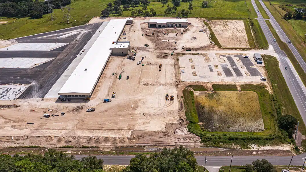
Industrial & Warehouse
Tilt-wall, steel erection, and large-footprint industrial builds. Aerial coverage captures the full scope of progress that ground-level documentation simply can’t match.
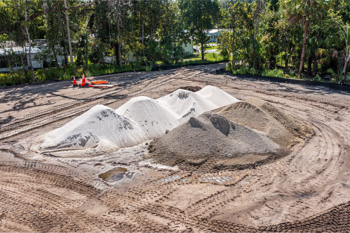
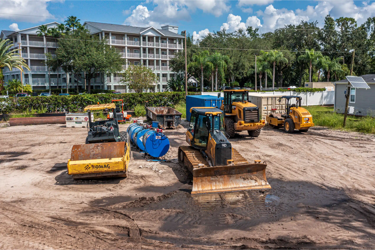
Land Development & Site Prep
Earthmoving, clearing, grading, utilities, and infrastructure phases. Aerial imagery is especially valuable during site prep, when changes happen fast and disputes over scope are most common.
Medical & Institutional
Hospitals, schools, government facilities, and campus expansions. Keep project owners, board members, and funding bodies informed with professional-grade aerial documentation.
Renovation & Expansion
Building additions, gut-rehab projects, and facility expansions. Document existing conditions before work begins, then track progress through completion for a complete before-and-after record.
Real-World Scenarios Where
Aerial Documentation Pays Off
Progress monitoring isn’t just about having pretty photos on file. Here are the specific situations where project managers across North Central Florida have relied on aerial documentation to protect their projects and their firms.
Lender Draw Inspections
Construction lenders often require documented evidence of completion percentage before releasing draw funds. Instead of scheduling a third-party inspector for every draw, aerial progress photos provide a clear, datestamped visual record that satisfies most lender requirements — delivered on your timeline.
Owner & Investor Reporting
Project managers managing properties on behalf of owners or investment groups are expected to provide regular progress updates. Our drone reports eliminate the need to compile your own photos after a site walk — just forward the flight package and the reporting is done.
Subcontractor Dispute Resolution
When a subcontractor claims work was completed before it actually was, or disputes the condition of a site at the start of their phase, aerial imagery from the relevant date is often the fastest path to resolution. Time-stamped photos don’t lie, and they hold up in mediation.
Schedule Slippage & Milestone Documentation
Aerial imagery taken at weekly or bi-weekly intervals creates a side-by-side comparison of what was promised versus what was delivered at each milestone. Use it in owner meetings, progress reviews, or to build a case for delay claims against trades that are behind schedule.
Safety & Compliance Documentation
Before an OSHA inspection or after a safety incident, dated aerial imagery of site conditions can establish what the site looked like before the event. This is especially valuable for general contractors managing high-risk phases like steel erection, excavation, or roofing.
Project Closeout & Punch Documentation
At project completion, a final aerial walkthrough creates a permanent, shareable record of the finished asset. Useful for marketing the owner's portfolio, documenting as-built conditions, and supporting future renovation or expansion planning. For marketing-grade final imagery, see our aerial photography and 4K video production services.
We manage 6 active projects across Marion and Alachua County. Before 352 Drone Services, I was spending 4–6 hours a week just compiling site photos and writing progress emails. Now I forward one link and I'm done. The lender draw photos alone have saved us from two disputes this year.
Project Manager
General Contractor — Ocala, FL
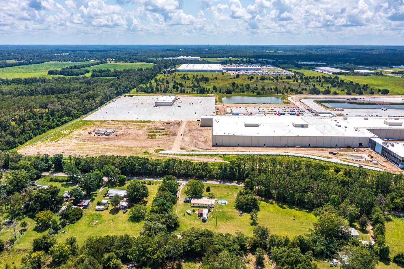
67 Consecutive Weeks:
Ben E. Keith Distribution Center
707,000 sq ft. 148 acres. Zero missed flights. See how weekly aerial progress documentation supported lender draw requests, subcontractor pay application validation, and schedule tracking across North Central Florida's largest active industrial build.
View the Full Case StudyAlso see: 34 on-time bi-weekly visits documenting Averitt's trucking service center in Ocala
Progress Monitoring
Packages
Per-Visit
One-time documentation
Best for: Single-site residential or light commercial projects with monthly owner reporting needs.
ROI: Eliminates one owner site visit
- Single site visit
- 20MP aerial stills
- 4K video walkthrough
- Delivery on your timeline
- Licensed for commercial use
Monthly
Active construction projects
Best for: Active commercial builds where bi-weekly documentation supports lender draws and milestone tracking.
ROI: Replaces 2 owner's rep visits/mo
- 2 visits per month
- 20MP aerial stills
- 4K video per visit
- Delivery on your timeline
- Progress comparison overlays
- Priority scheduling
Weekly
Fast-track or high-visibility projects
Best for: Large-scale or multi-phase projects requiring weekly documentation, stakeholder reporting, and full visual archives.
ROI: Full visual archive + dispute protection
- Weekly visits
- 20MP aerial stills
- 4K video per visit
- Delivery on your timeline
- Monthly progress reel
- Priority scheduling
- Dedicated pilot assignment
Custom packages available for large-scale or multi-site projects. Contact us for pricing.
No New Software Required
Our deliverables are designed to plug directly into the tools your team already uses — no new platforms, no learning curve.
Google Drive
Shared delivery folder
Dropbox
Shared delivery folder
Procore
File-compatible photo upload
Buildertrend
Progress photo integration
CoConstruct
Client reporting
Autodesk Build
File-compatible document import
Email / Slack
Direct link sharing
Any Browser
No app install needed
Professional
DJI Mavic-Series
Drone Fleet
We operate DJI Mavic-series professional drones equipped with 4K cameras and advanced GPS systems. Our equipment is regularly maintained and certified for commercial operations. Every flight plan is pre-approved, documented, and delivered with your project records.
Construction Progress Monitoring
FAQ
Construction progress monitoring is a systematic aerial documentation service where FAA-certified drone pilots capture high-resolution photos and 4K video of a construction site at regular intervals — weekly, bi-weekly, or monthly. The resulting imagery creates a visual record of the project's evolution from groundbreaking through completion, used by project managers, owners, and investors to track progress, verify milestones, and document site conditions.
Drone monitoring provides a bird's-eye perspective that ground-level walkthroughs simply cannot replicate. A single aerial flight captures the entire site in minutes, revealing drainage issues, material staging problems, schedule deviations, and safety concerns that are invisible from the ground. For PMs managing multiple projects or working with out-of-state owners, aerial monitoring dramatically reduces the need for costly travel while improving the quality of stakeholder reporting.
Frequency depends on project pace and stakeholder requirements. For active commercial construction, weekly visits are the most popular choice — providing the tightest visual record and the fastest issue detection. Bi-weekly and monthly options are also available for projects with lighter documentation needs. We recommend scheduling visits to align with key milestones: pre-pour, framing completion, roofing, and substantial completion.
After each visit, you receive a full set of 20-megapixel aerial stills covering the entire site, plus a 4K video walkthrough. Files are delivered on your timeline — flexible to meet your schedule and reporting needs. Files are organized by date and area for easy reference. For weekly packages, we can also produce edited monthly progress reels suitable for owner meetings and investor presentations.
Yes. We serve construction projects throughout Marion County (Ocala), Alachua County (Gainesville), and Sumter County (Wildwood, The Villages). We also serve projects along the I-75 corridor and throughout North Central Florida. Contact us to confirm coverage for your specific project location.
Yes. We carry $2M+ commercial aviation liability insurance and our pilots hold FAA Part 107 Remote Pilot Certificates. Certificates of insurance are available upon request and can be added to your project's insurance file.
All deliverables are uploaded to a shared Google Drive or Dropbox folder after each flight. You can forward the folder link to your owner, lender, or investment group directly — no login or special software required on their end. We can also organize the folder by milestone phase (grading, foundation, framing, etc.) if that format works better for your reporting needs.
Yes, and many of our clients do exactly that. Our photos are timestamped, geotagged, and delivered in a format that clearly shows site conditions on a specific date. While each lender has their own draw inspection requirements, aerial photo documentation is widely accepted as supporting evidence and can reduce the need for third-party inspector visits on routine draw requests. We recommend confirming with your specific lender in advance.
We monitor conditions in advance of every scheduled flight. If high winds, rain, or low visibility make it unsafe or impractical to fly, we will notify you as early as possible and reschedule within 1–2 business days at no additional charge. For projects with strict reporting deadlines, we recommend scheduling flights mid-week to preserve rescheduling flexibility.
Yes. We coordinate directly with your site superintendent to identify a safe window during the workday — typically during a natural break, lunch, or at end of day. FAA Part 107 rules require us to maintain safe distances from personnel, and our pilots are experienced at navigating active job sites professionally and without disrupting work.
Yes. We offer multi-site contracts for general contractors, developers, and project management firms managing multiple active projects simultaneously. Multi-site agreements typically include volume pricing and a dedicated scheduling contact. Contact us to discuss your portfolio.
For standard recurring visits, we recommend scheduling 48–72 hours in advance to ensure pilot availability and permit any required airspace coordination. For one-time or urgent documentation needs, contact us directly — we can often accommodate short-notice requests within 24 hours depending on location and current availability.
Construction Progress Monitoring Near You
Progress Monitoring in Ocala
Marion County's leading aerial construction documentation service.
Progress Monitoring in Gainesville
Serving UF-area and Alachua County construction projects.
Progress Monitoring in Wildwood
I-75 corridor and Sumter County site documentation.
Progress Monitoring in Belleview
South Marion County residential and rural development coverage.
Progress Monitoring in The Villages
Sumter County amenity and commercial construction documentation.
Progress Monitoring in Spring Hill
Hernando County SR-52 corridor and Suncoast Pkwy growth area.
Progress Monitoring in Crystal River
Citrus County coastal industrial and residential projects.
Progress Monitoring in Leesburg
Lake County US-27 corridor and Villages spillover growth.
Progress Monitoring in Clermont
Lake County's fastest-growing city — Wellness Way corridor.
Progress Monitoring in Brooksville
Hernando County seat commercial and civic projects.
Progress Monitoring in Dunnellon
Marion/Levy border — 250+ active development projects.
Progress Monitoring in Newberry
Alachua County I-75 corridor fast-growing community.
Progress Monitoring in Lady Lake
Lake County Villages-adjacent active subdivision development.
Progress Monitoring in Alachua
US 441 industrial corridor — Ben E. Keith DC and Progress Corporate Park.