Construction Drone Services
in Alachua, FL
Warehouse & Distribution Center Specialists
FAA Part 107 certified aerial documentation for large-scale industrial builds on the US 441 corridor. Pre-construction baselines, weekly progress monitoring, and site mapping for Alachua's growing logistics and distribution sector.
Drone Documentation for Alachua's
Largest Construction Projects
The City of Alachua is in the middle of a significant industrial expansion along the US 441 corridor. With the Ben E. Keith Foods 707,000 sq ft distribution center under active construction through fall 2026, the G&C Foods 250,000+ sq ft cold storage campus, and ongoing development at Progress Corporate Park, Alachua represents one of North Central Florida's most active large-scale construction markets.
352 Construction Drone Services provides FAA-certified aerial documentation for these large-format industrial builds. Our pilots cover the full site footprint — including building pads, parking fields, loading dock infrastructure, and stormwater systems — in a single coordinated flight. We deliver consistent, timestamped visual records that satisfy lender draw requirements, owner reporting obligations, and project milestone documentation.
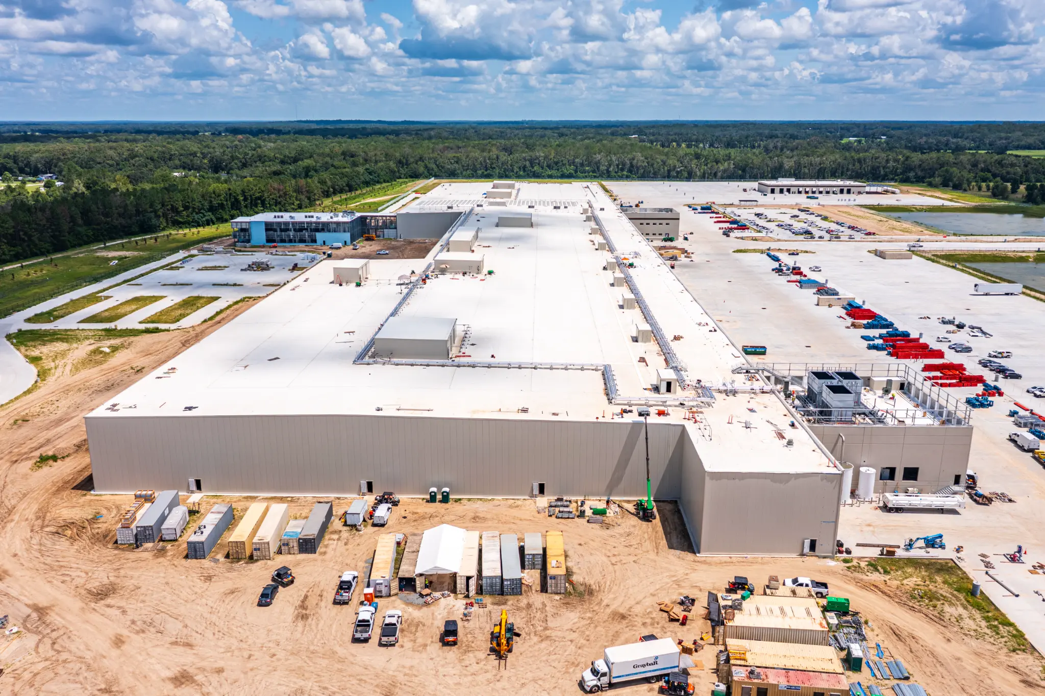
Warehouse & Dock Infrastructure
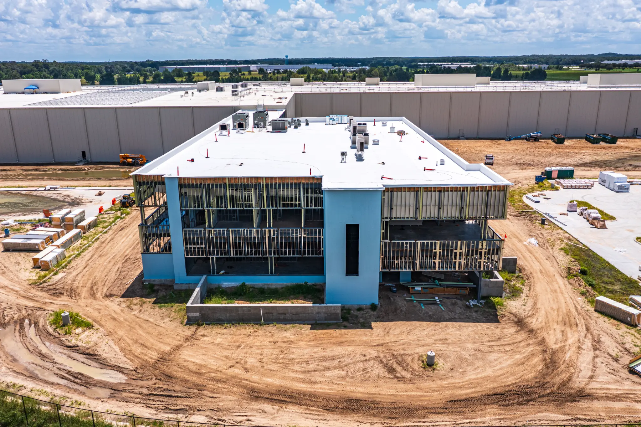
Office Building Progress
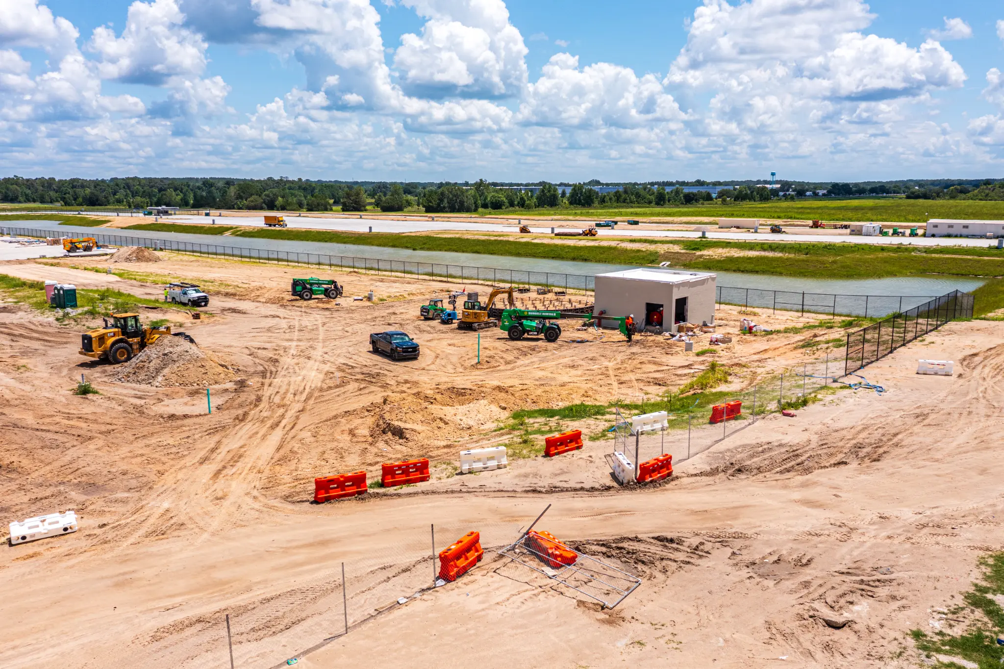
Sitework & Stormwater
Alachua's Major Industrial Projects:
Why Aerial Documentation Matters
Ben E. Keith Foods DC
707,000 sq ft distribution center on 148 acres — one of Florida's largest and most technologically advanced food distribution facilities. Under active construction through fall 2026.
G&C Foods Cold Storage
250,000+ sq ft cold storage and distribution campus serving the Southeast region. A 70-acre industrial campus representing a major logistics investment in Alachua.
Progress Corporate Park
204-acre science and technology park on Innovation Drive with nearly 1 million sq ft of office, laboratory, and research space. Home to 30+ biotech and technology companies.
Large industrial builds require large-scale documentation. A 700,000 sq ft distribution center on 148 acres cannot be adequately documented from ground level. Aerial drone coverage captures the full project scope — building progress, site work, utility installation, and surrounding infrastructure — in a single consistent record. For lenders, owners, and out-of-state stakeholders, this is the most efficient way to verify progress on Alachua's major construction projects.
Site Documentation Gallery:
Visits 66 & 67 — June–July 2026
Every site visit produces a complete visual record — from structural framing and rooftop MEP to active sitework, utility trenching, and landscaping staging. These six frames from back-to-back visits illustrate the breadth of detail captured in a single drone session.
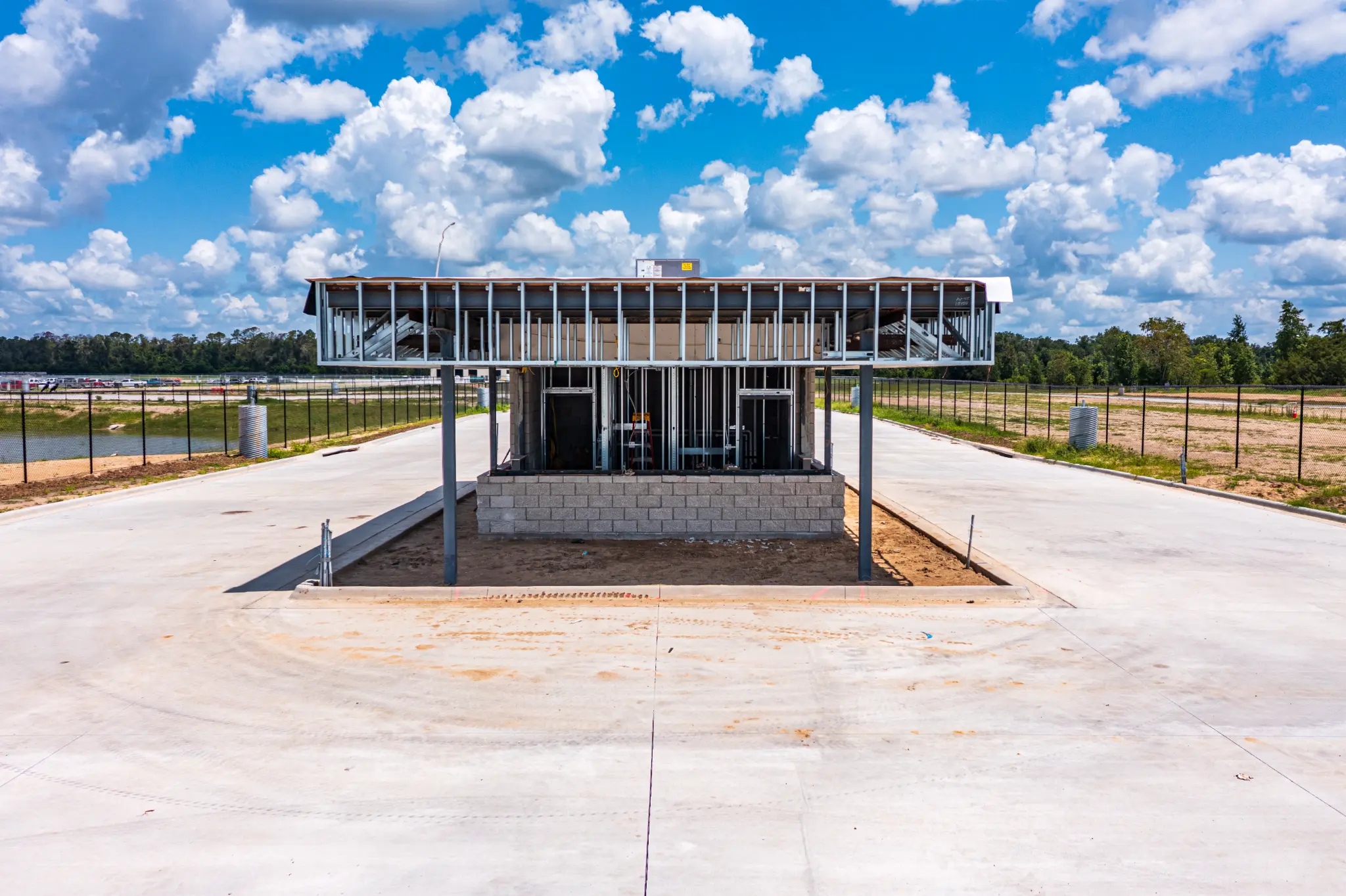
Guardhouse — Framing & CMU
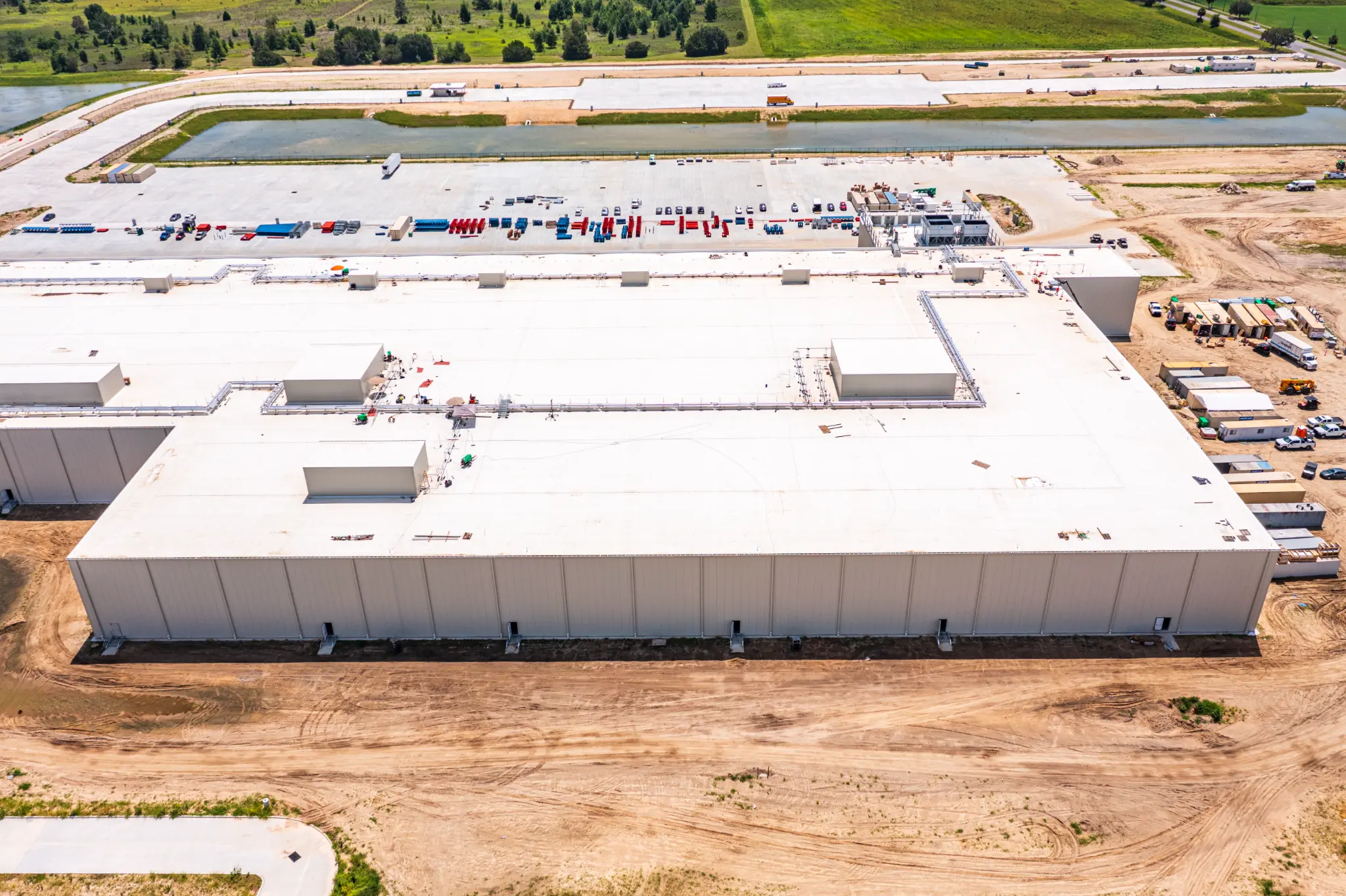
Warehouse — Side Elevation
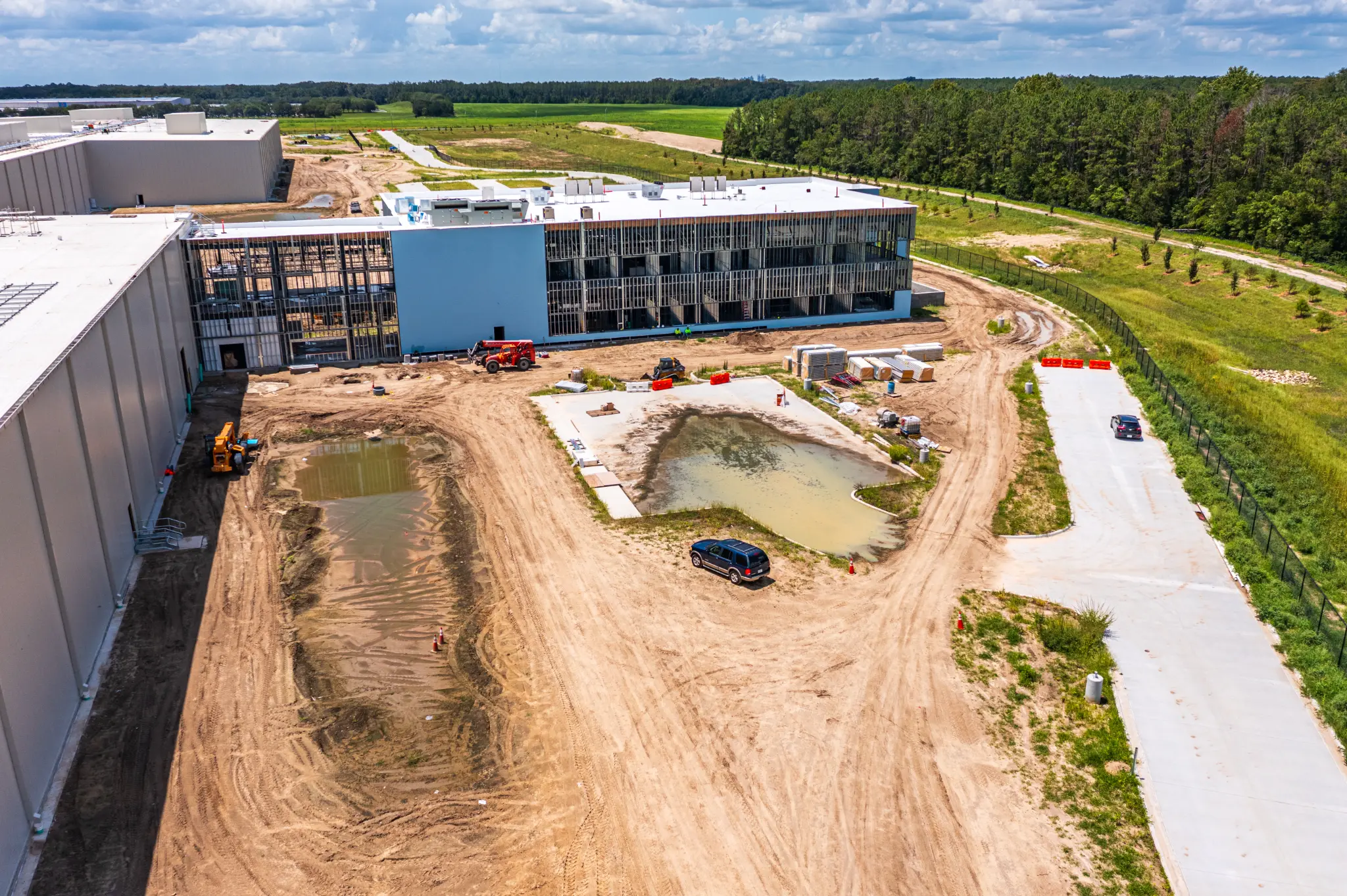
Office Building & Stormwater
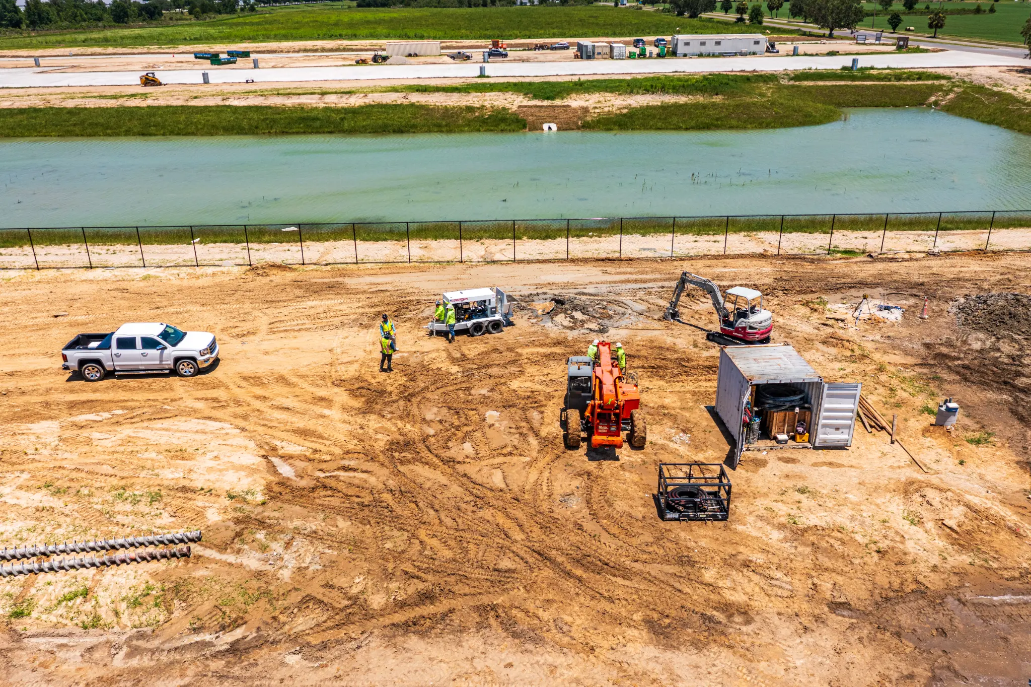
Telehandler — Active Sitework
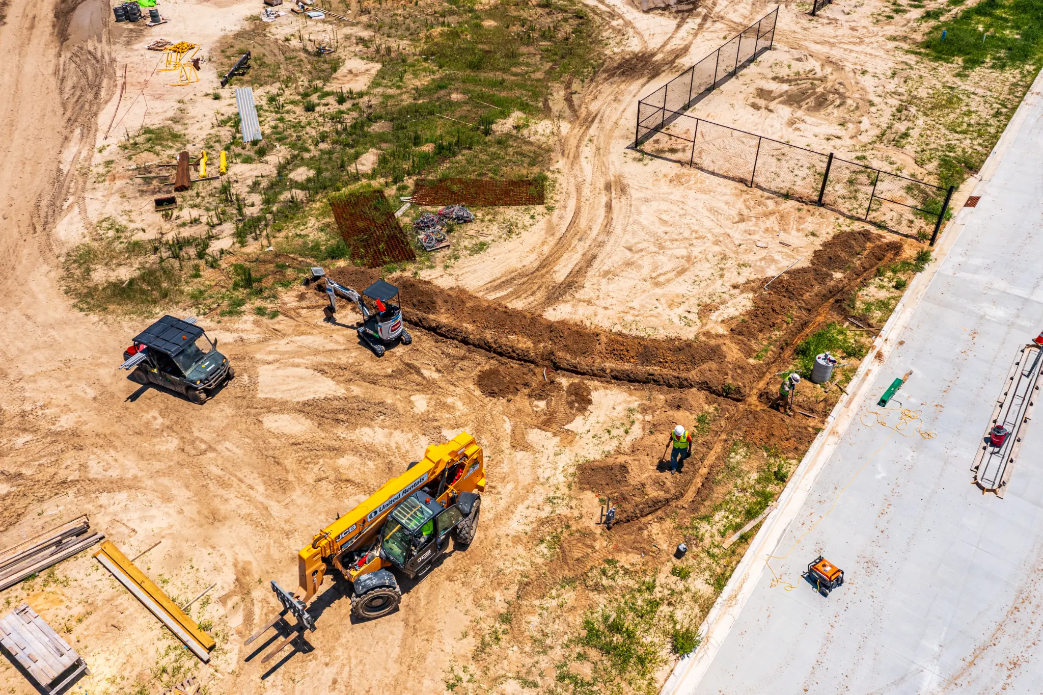
Excavator — Utility Trenching
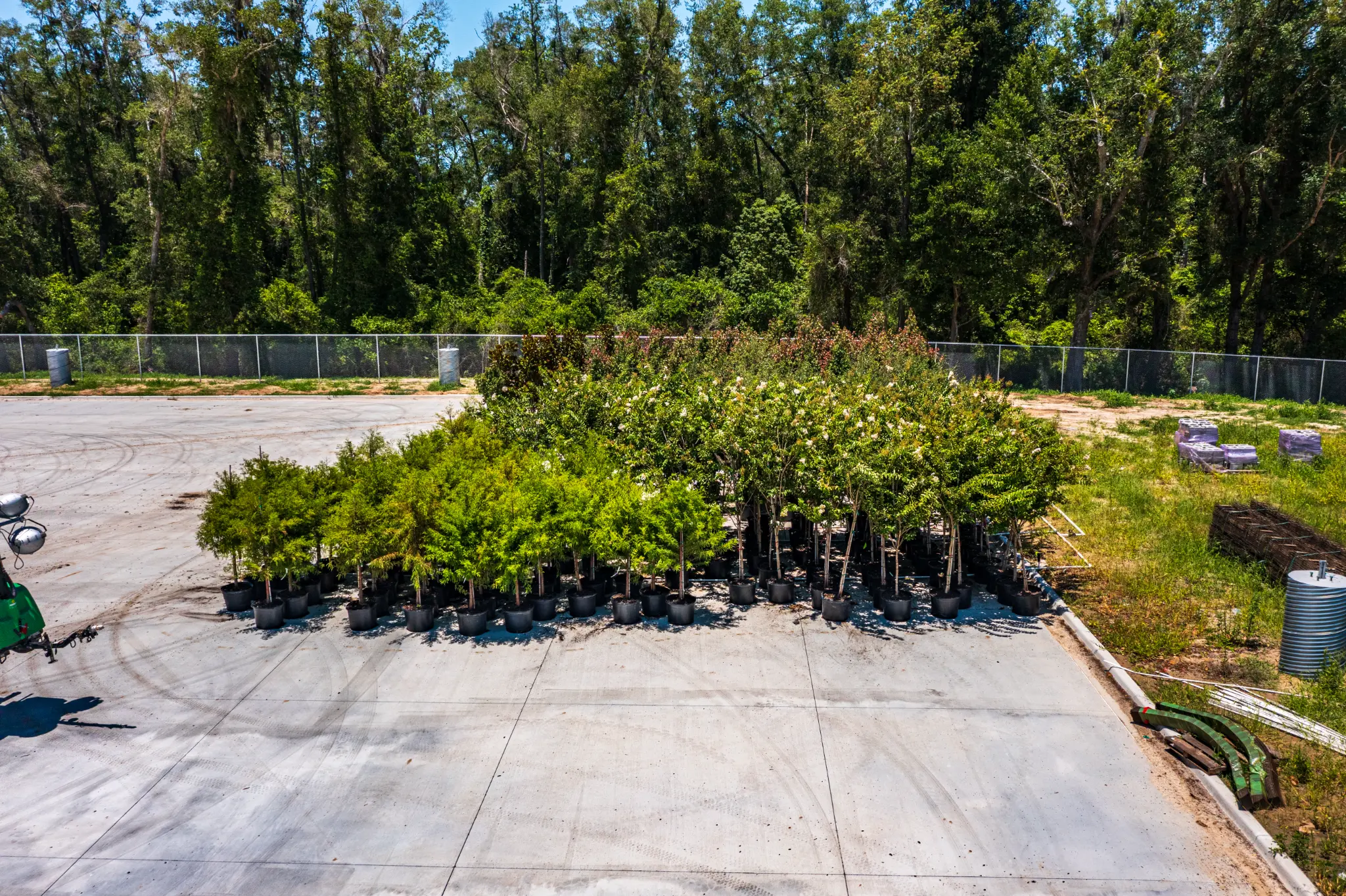
Landscaping — Nursery Staging
Drone Services for Industrial & Warehouse
Construction in Alachua
Pre-Construction Documentation
Establish a verified visual baseline before your Alachua warehouse or distribution center breaks ground. We capture 4K video and 20MP aerial stills of the undisturbed site — documenting existing conditions, drainage patterns, and adjacent property boundaries for your legal record.
Learn MoreConstruction Progress Monitoring
Weekly or bi-weekly aerial documentation of your large-scale Alachua build. Ideal for the 707,000 sq ft Ben E. Keith distribution center and similar industrial projects — giving developers, lenders, and out-of-state stakeholders a consistent visual record from foundation to final inspection.
Learn MoreAerial Photography
High-resolution 20MP aerial stills for Alachua industrial and commercial projects. Professional imagery for project bidding, investor presentations, marketing materials, and milestone documentation on US 441 corridor developments.
Learn MoreSite Mapping
2D orthomosaic mapping for large-acreage Alachua industrial sites. Useful for earthwork volume estimates, grading verification, and site planning on the 70–148 acre campuses typical of Alachua's distribution and logistics developments.
Learn MoreFlying in Alachua:
Airspace & FAA Compliance
Alachua City Airspace
The City of Alachua is generally in uncontrolled airspace (Class G/E), which simplifies drone operations compared to flying near controlled airports. Our pre-flight process includes:
- Verify airspace class via FAA B4UFLY app before every flight
- Check for any active TFRs or NOTAMs in the area
- Confirm LAANC authorization requirements for each site
- Review proximity to GNV approach paths for northern Alachua sites
- Document all pre-flight checks for your project compliance file
Proximity to GNV Airport
Gainesville Regional Airport (GNV) is approximately 15 miles south of Alachua. Some sites near the southern edge of Alachua County may fall within GNV's Class D airspace or approach corridors. When this applies, our pilots:
- Obtain FAA authorization via the LAANC system
- File a Part 107 waiver for operations requiring special consideration
- Coordinate directly with GNV Air Traffic Control
- Notify GNV Airport Operations before each flight
- Provide all clearance documentation for your project file
We handle all airspace coordination on your behalf. You focus on your project timeline — we manage the FAA authorizations, airspace checks, and any required notifications. All clearances are documented and provided to you as part of your project file.
Alachua Drone Services
Frequently Asked Questions
Yes. 352 Construction Drone Services operates throughout Alachua County, including the City of Alachua, Gainesville, Newberry, High Springs, and surrounding areas. Our FAA Part 107 certified pilots are authorized for commercial drone operations throughout North Central Florida.
Absolutely — large industrial builds are one of our core specialties. Distribution centers and warehouse campuses of 100,000 to 700,000+ square feet benefit enormously from consistent aerial documentation. We capture the full footprint of the building, site work, parking, loading docks, and surrounding infrastructure in a single flight. For projects like the Ben E. Keith Foods 707,000 sq ft facility in Alachua, we can provide weekly progress documentation from foundation pour through roof completion and site work.
The City of Alachua itself is generally in uncontrolled airspace (Class G/E), which simplifies drone operations compared to flying near Gainesville Regional Airport (GNV). However, some areas near Alachua may fall within GNV's approach paths or other temporary flight restrictions. Our pilots verify current airspace status via the FAA's B4UFLY app and the LAANC system before every flight, and we handle any required authorizations on your behalf.
For projects that fall within GNV's Class D airspace or approach corridors, our pilots obtain FAA authorization through the LAANC (Low Altitude Authorization and Notification Capability) system or by filing a formal Part 107 waiver. We coordinate directly with GNV Air Traffic Control when required and document all clearances for your project file. Most Alachua city projects are outside the controlled airspace boundary, but we always verify before scheduling.
Pricing depends on project scope, site acreage, flight frequency, and deliverables. We offer per-visit rates for one-time aerial photography and monthly retainer packages for ongoing construction progress monitoring. Large industrial sites (100+ acres) may require multiple battery cycles per visit to achieve full coverage. Contact us for a free quote tailored to your Alachua project.
We typically schedule Alachua flights within 1–3 business days of booking. For time-critical captures — pre-pour documentation, lender draw inspections, milestone deadlines — call 352.955.8565 and we'll work around your pour schedule, not ours.
Yes. We carry $2M+ commercial aviation liability insurance covering all drone operations in Alachua and throughout Florida. Up to $5M in additional coverage is available upon request for projects with higher limits required by lenders or general contractors. Certificates of insurance naming your GC or owner as certificate holder are available on request.
Yes. Progress Corporate Park is a 204-acre science and technology campus on Innovation Drive in Alachua, home to 30+ biotech and research companies. We can provide aerial documentation for construction projects, facility expansions, and marketing imagery throughout the park. The campus is in uncontrolled airspace, and we handle all required pre-flight planning.
Serving Alachua &
All of North Central Florida
We serve construction and industrial projects throughout Alachua, Gainesville, Newberry, High Springs, and surrounding Alachua County communities. We also serve Marion County (Ocala) and Sumter County (Wildwood, The Villages).