34 Drone Visits Documenting
Averitt's Ocala, FL
Service Center Build
Bi-weekly drone construction progress photos for a 53-door cross-dock trucking terminal near I-75 in Ocala — every scheduled visit flown and delivered on time, closing with twilight and night photography of the completed facility.
The Project: A 53-Door Freight
Service Center Near I-75 in Ocala
When Averitt — one of the nation's largest trucking and logistics companies — announced a new freight service center in Ocala, it joined a wave of logistics investment along Marion County's I-75 corridor. The facility is a 53-door cross-dock trucking terminal with extensive truck and trailer parking, built by a national general contractor on a schedule that left no room for documentation gaps.
The challenge was the one every project manager on an industrial build knows: stakeholders scattered across the country, a lender and owner's team that need verifiable progress records, and a building too long to photograph meaningfully from the ground. The project needed construction progress drone photography in Ocala, Florida that would show up on schedule, every time, and produce comparable photo sets from visit to visit.
Our approach: bi-weekly flights on a fixed schedule, standardized angles and altitudes for true set-to-set comparability, and delivery of every photo set on time — 34 visits scheduled, 34 flown, zero missed. The engagement closed with a twilight and night aerial shoot of the completed terminal, giving Averitt and the project team both a complete construction record and completion imagery ready for announcements and marketing.
Project Specifications
| Facility Type | Freight Service Center — 53-Door Cross-Dock |
| Client | Averitt |
| General Contractor | A national general contractor |
| Location | Ocala, FL — Marion County, near I-75 |
| Total Visits | 34 scheduled · 34 flown |
| Archive Span | Nov 2024 – Feb 2026 (Visits 6–34) |
| Flight Cadence | Bi-weekly |
| Deliverables | High-res aerial progress photos each visit |
| Completion Set | Twilight & night aerial photography |
| Reliability | 34/34 on-time · 0 missed flights |
Bi-Weekly Drone Progress Documentation
From Sitework to Completion
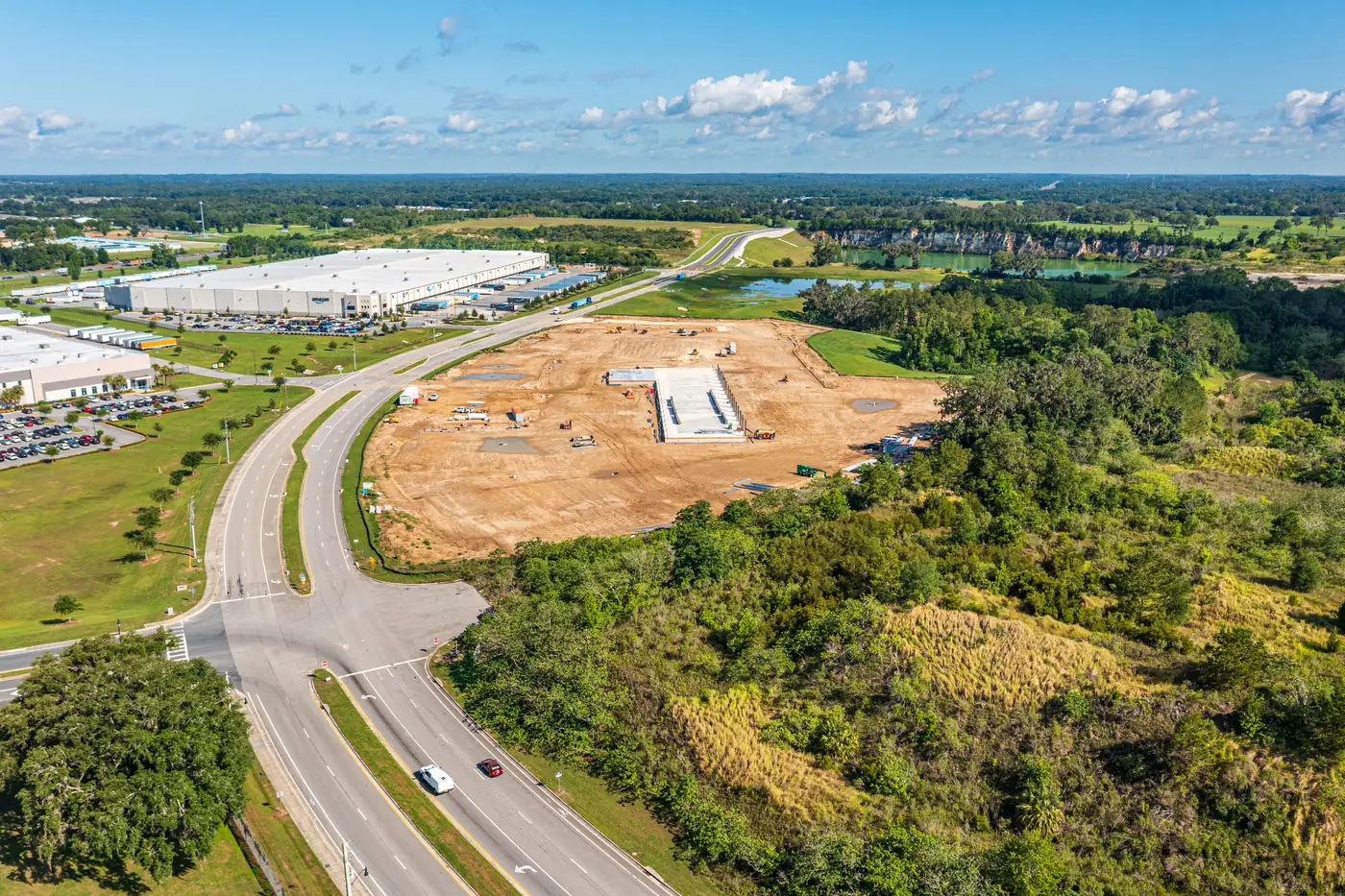
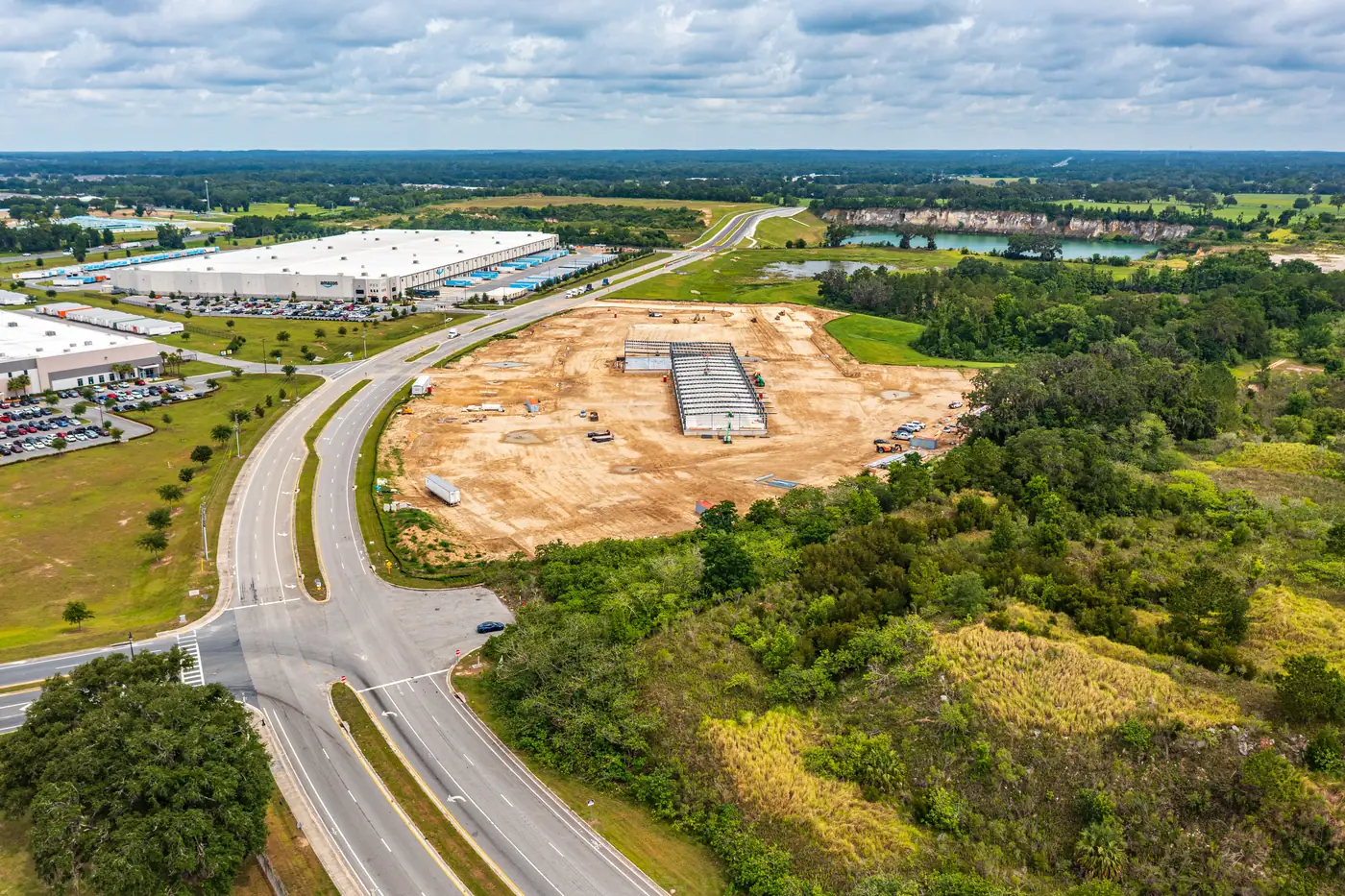
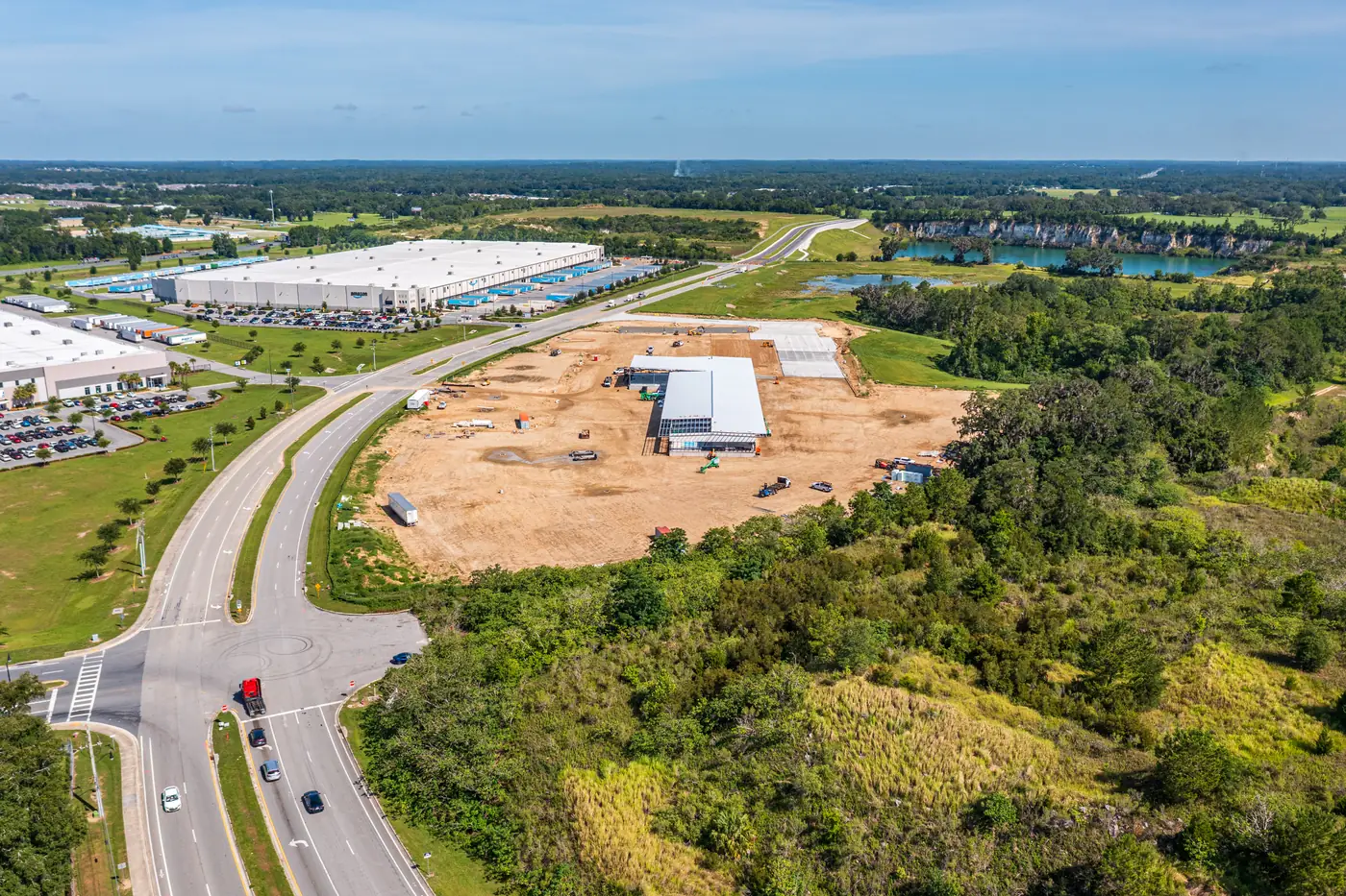
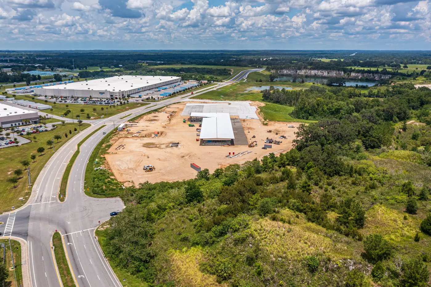
Drag the slider to move through the chronological archive — one representative aerial photo per visit, Visits 6 through 34. Because every flight used standardized angles and altitudes, any two positions on this timeline are directly comparable.
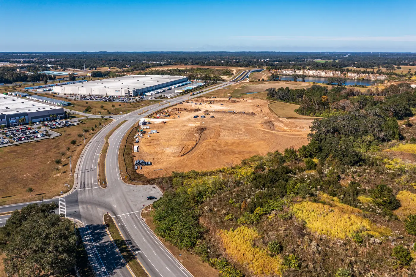
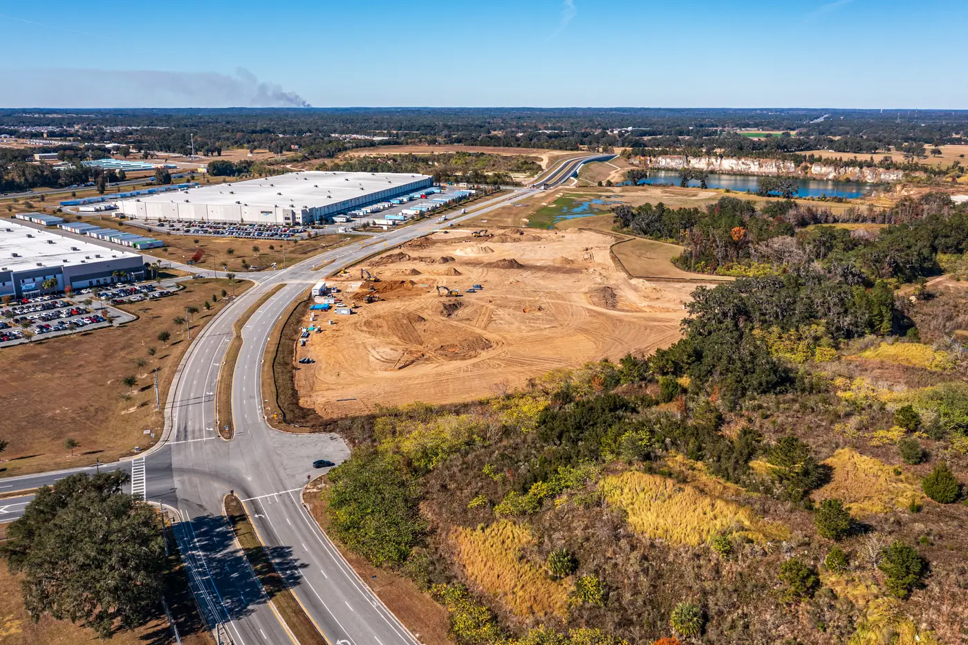
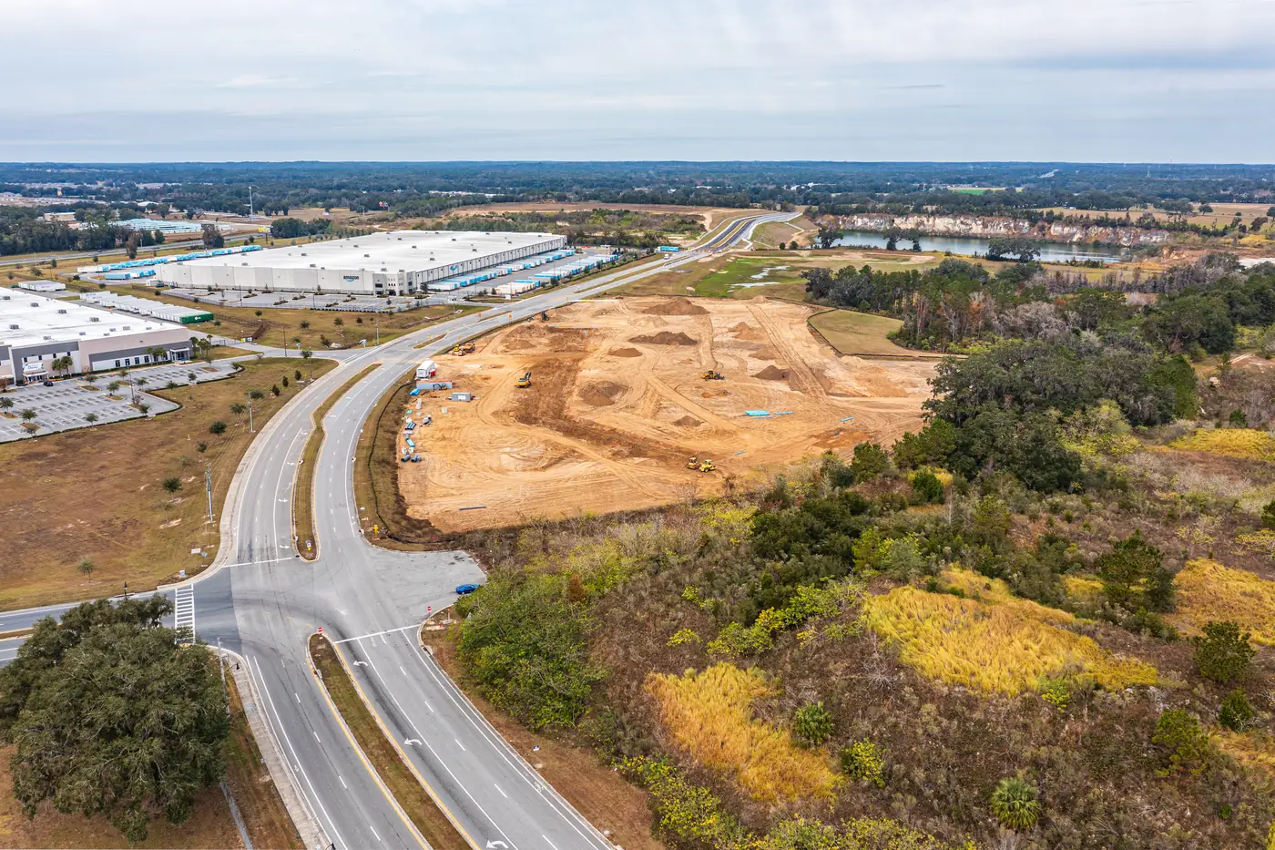
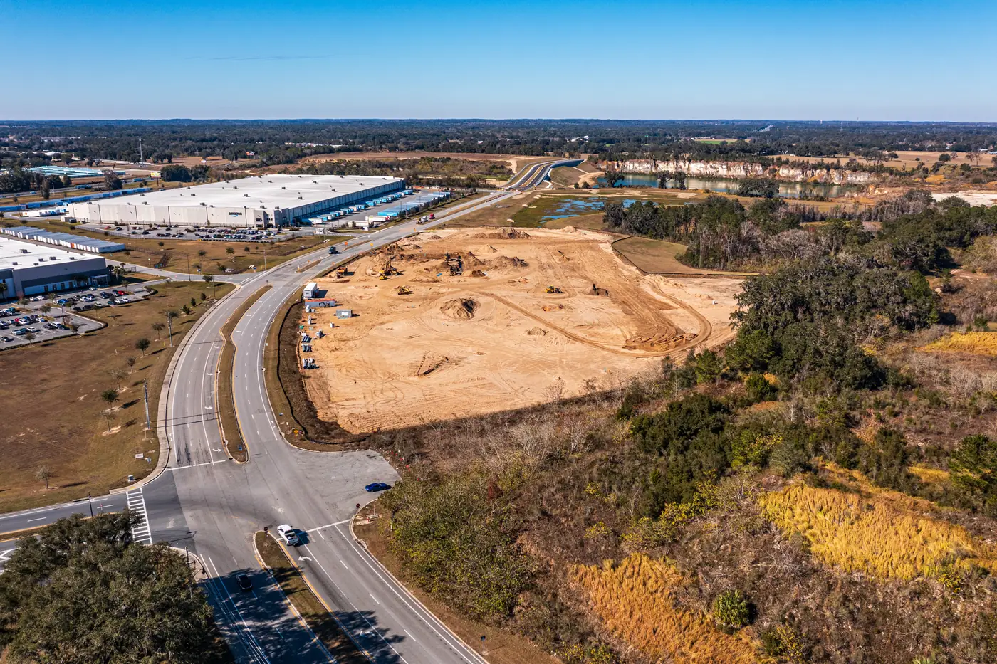
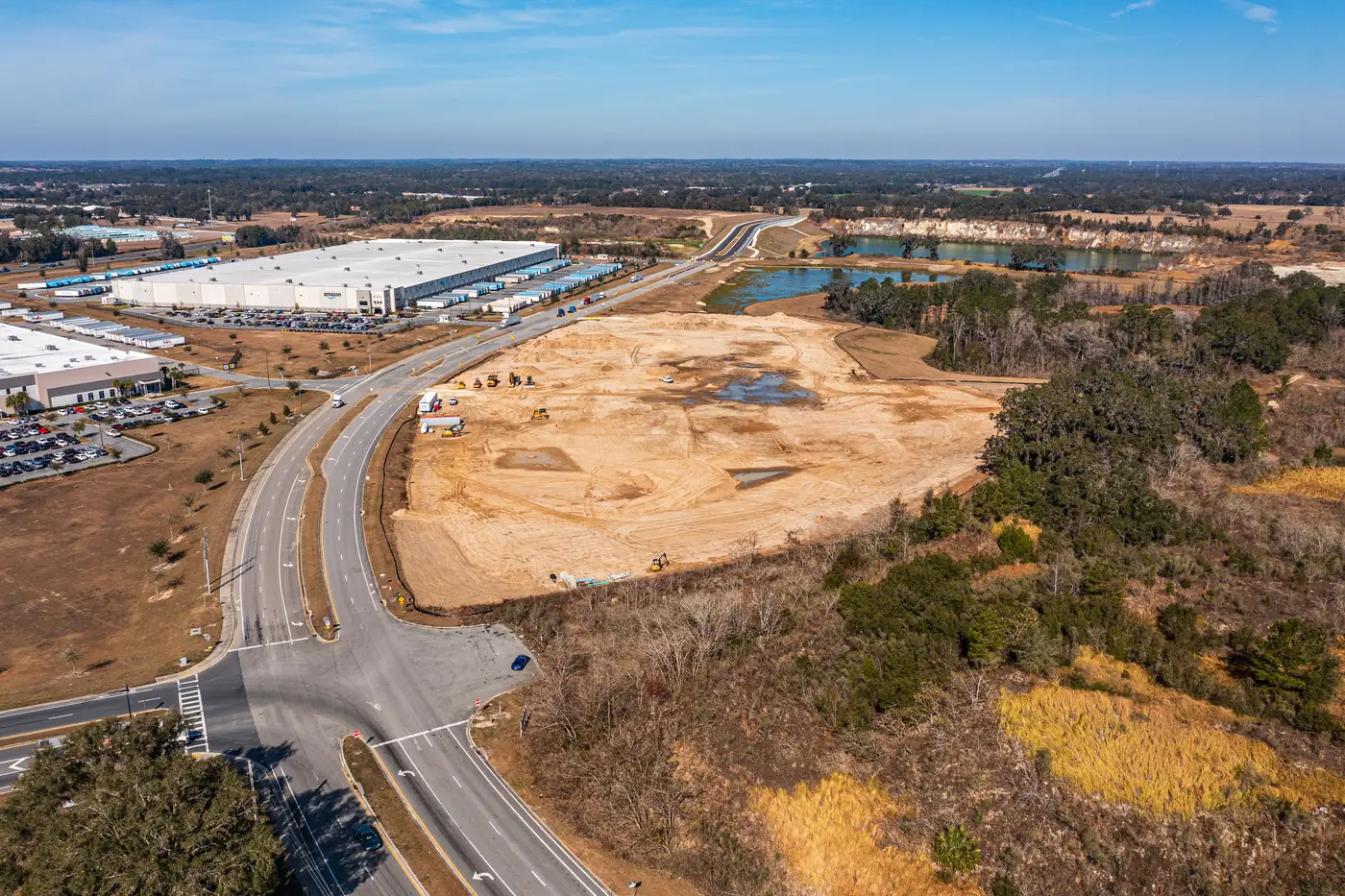
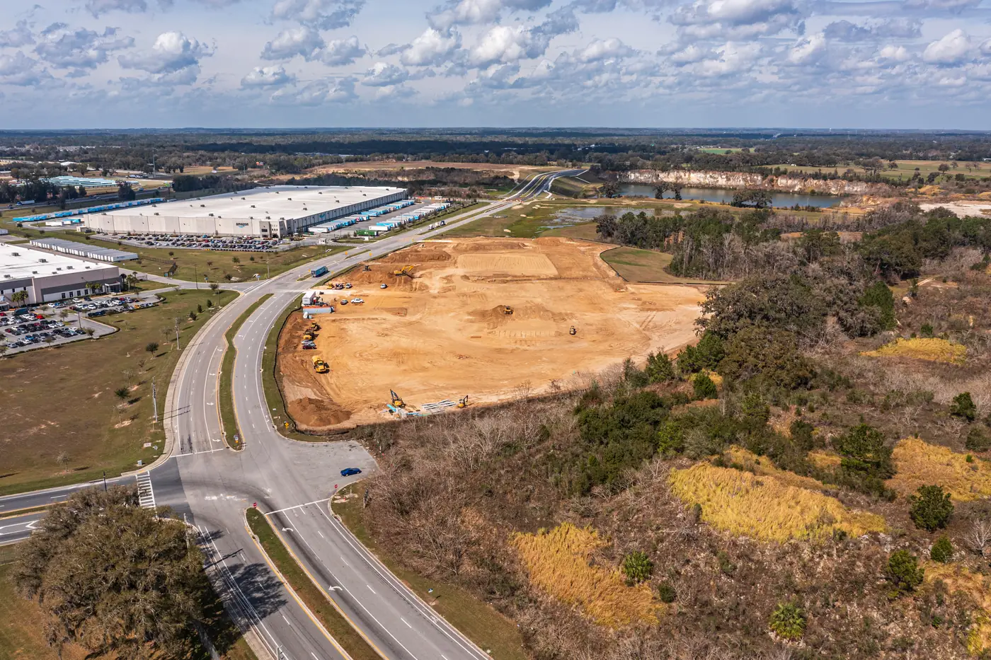
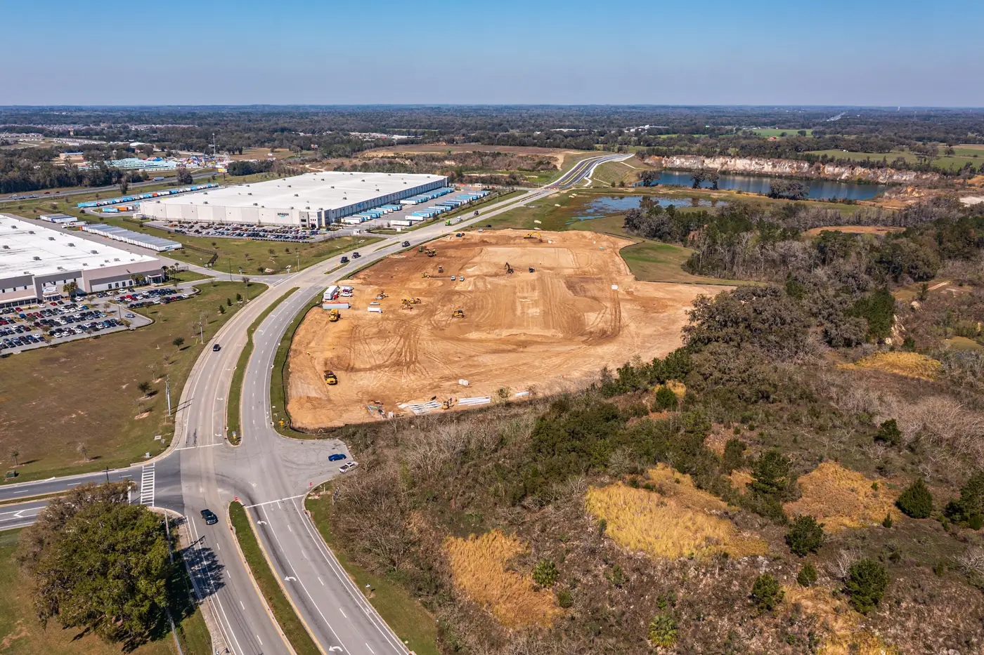
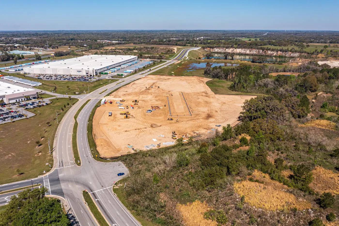
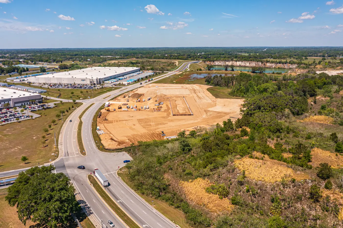
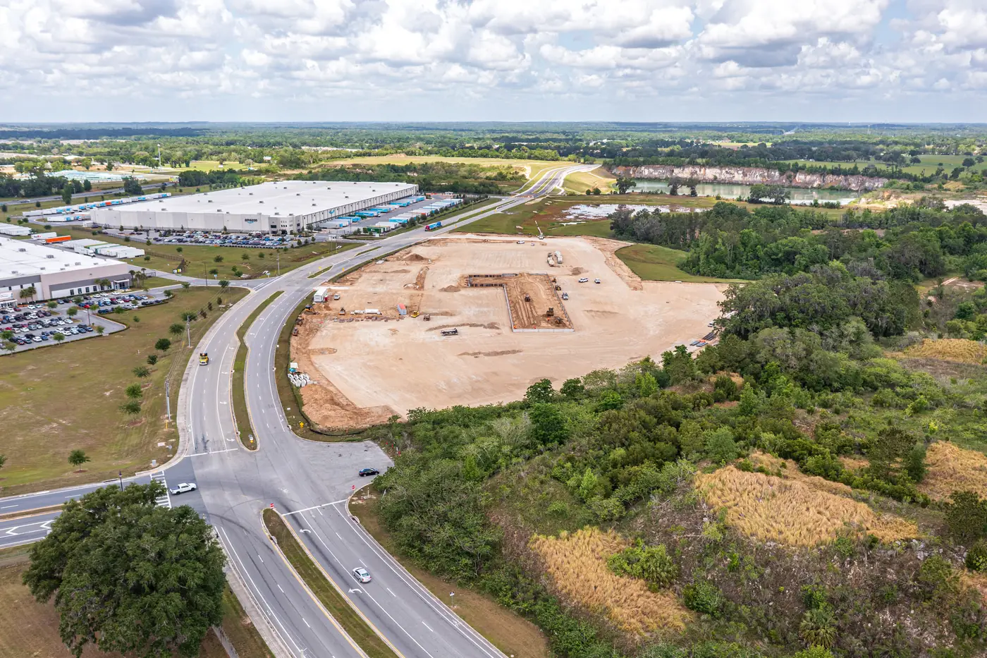
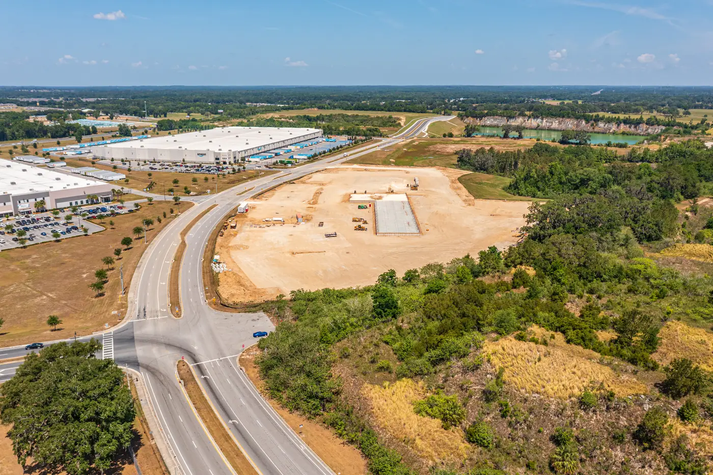
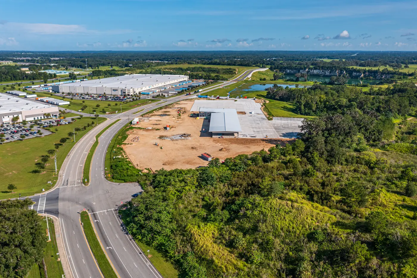
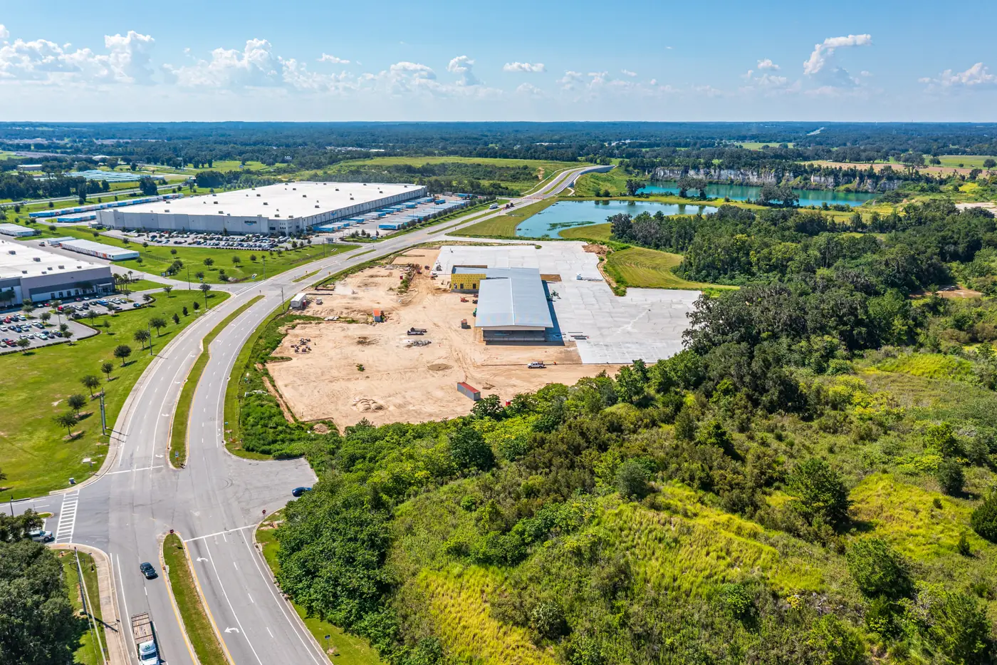
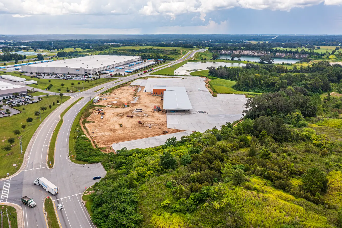
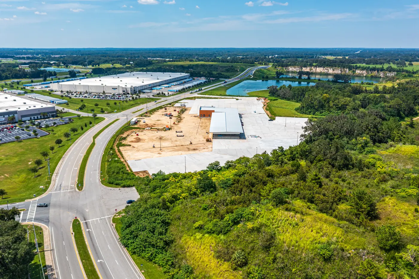
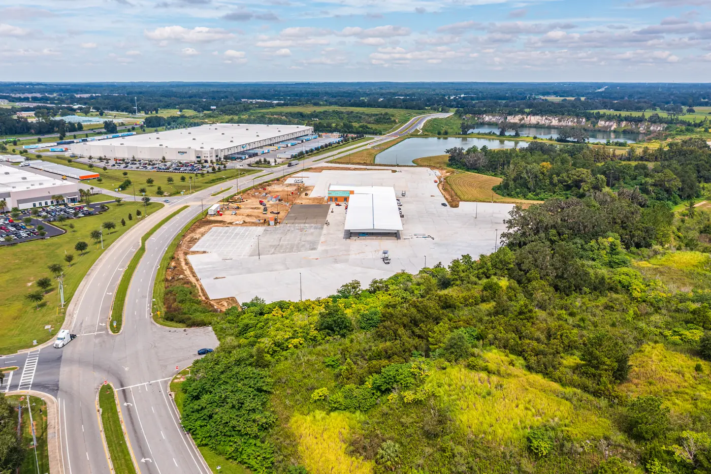
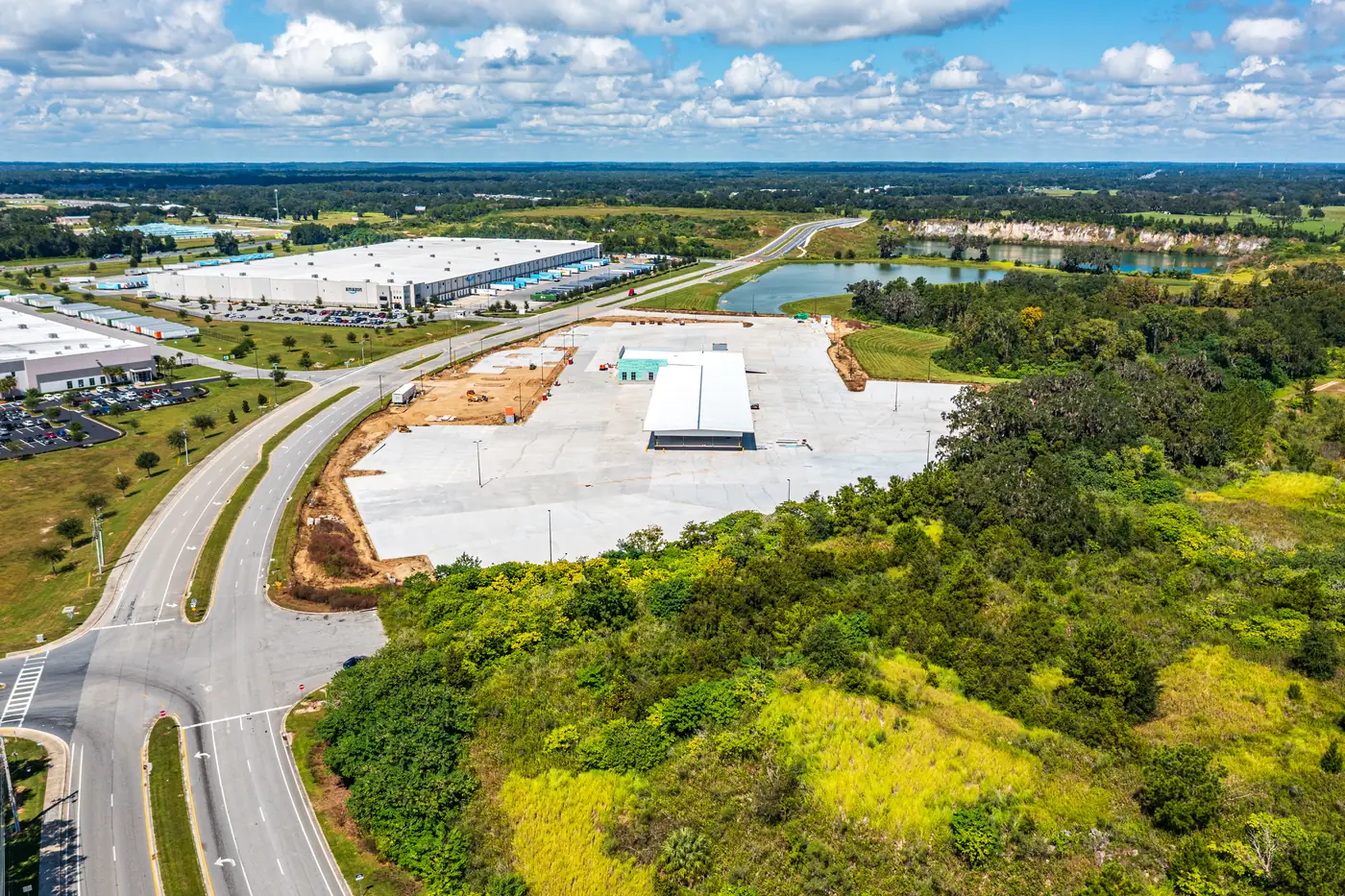
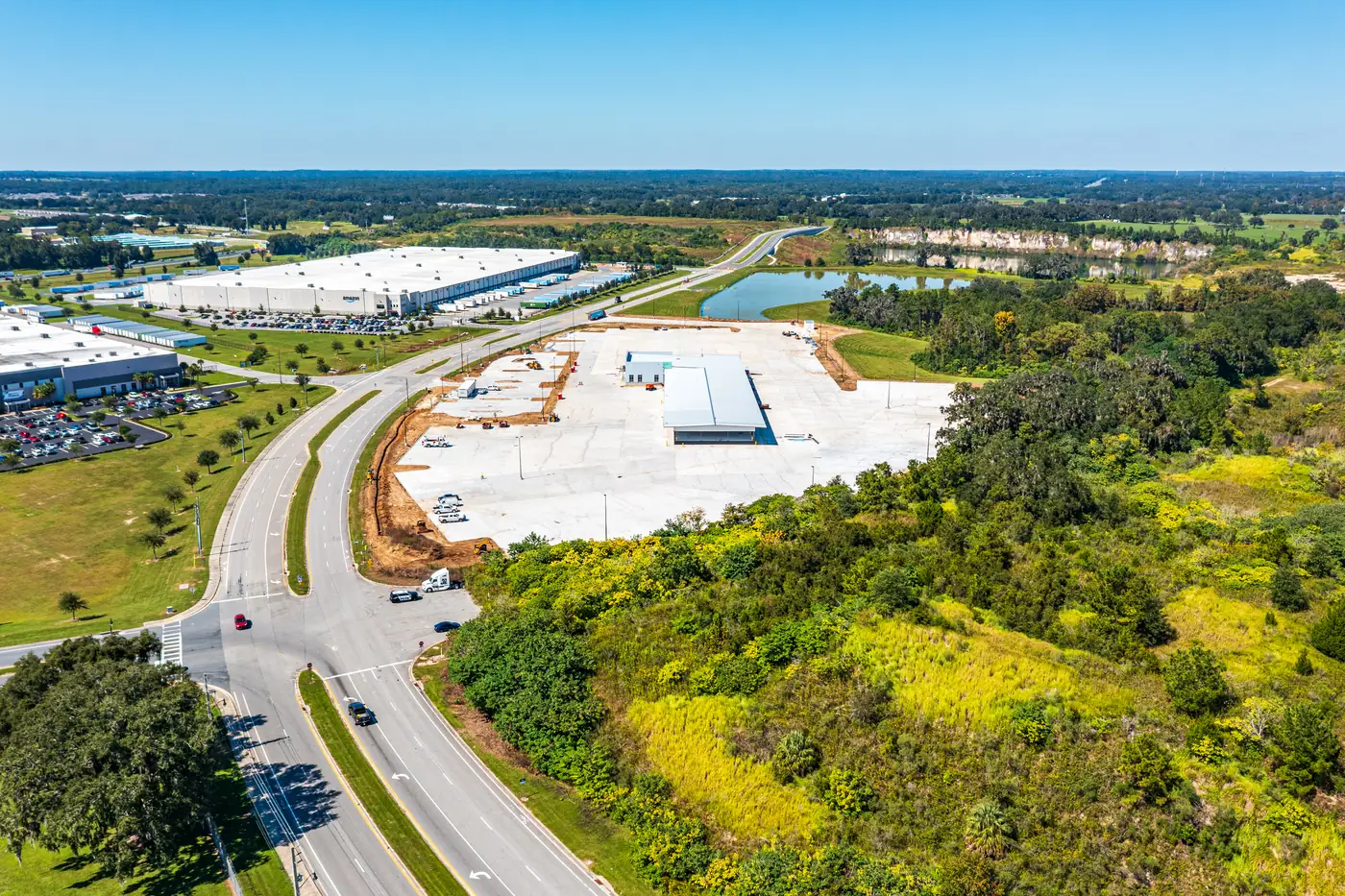
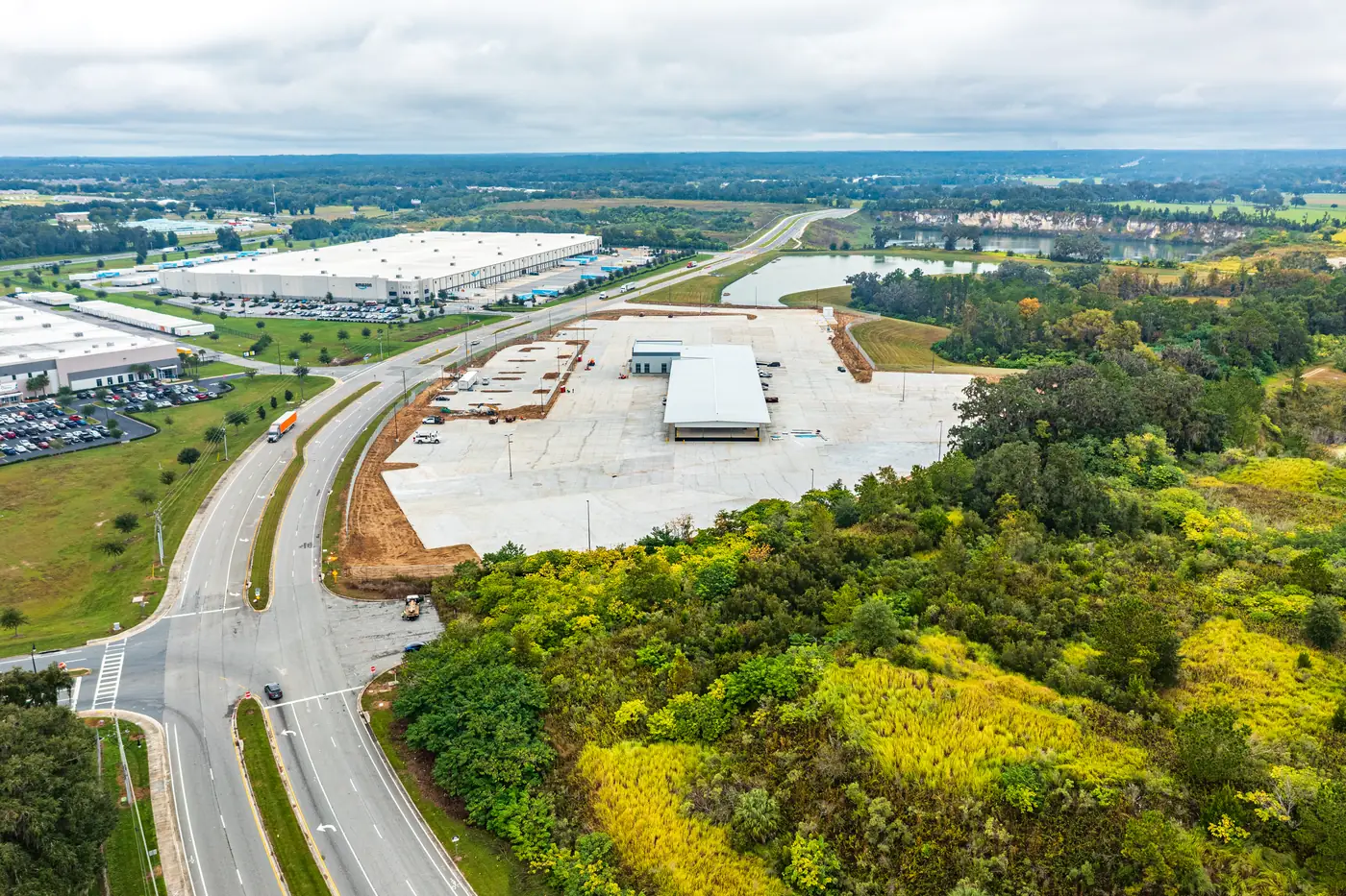
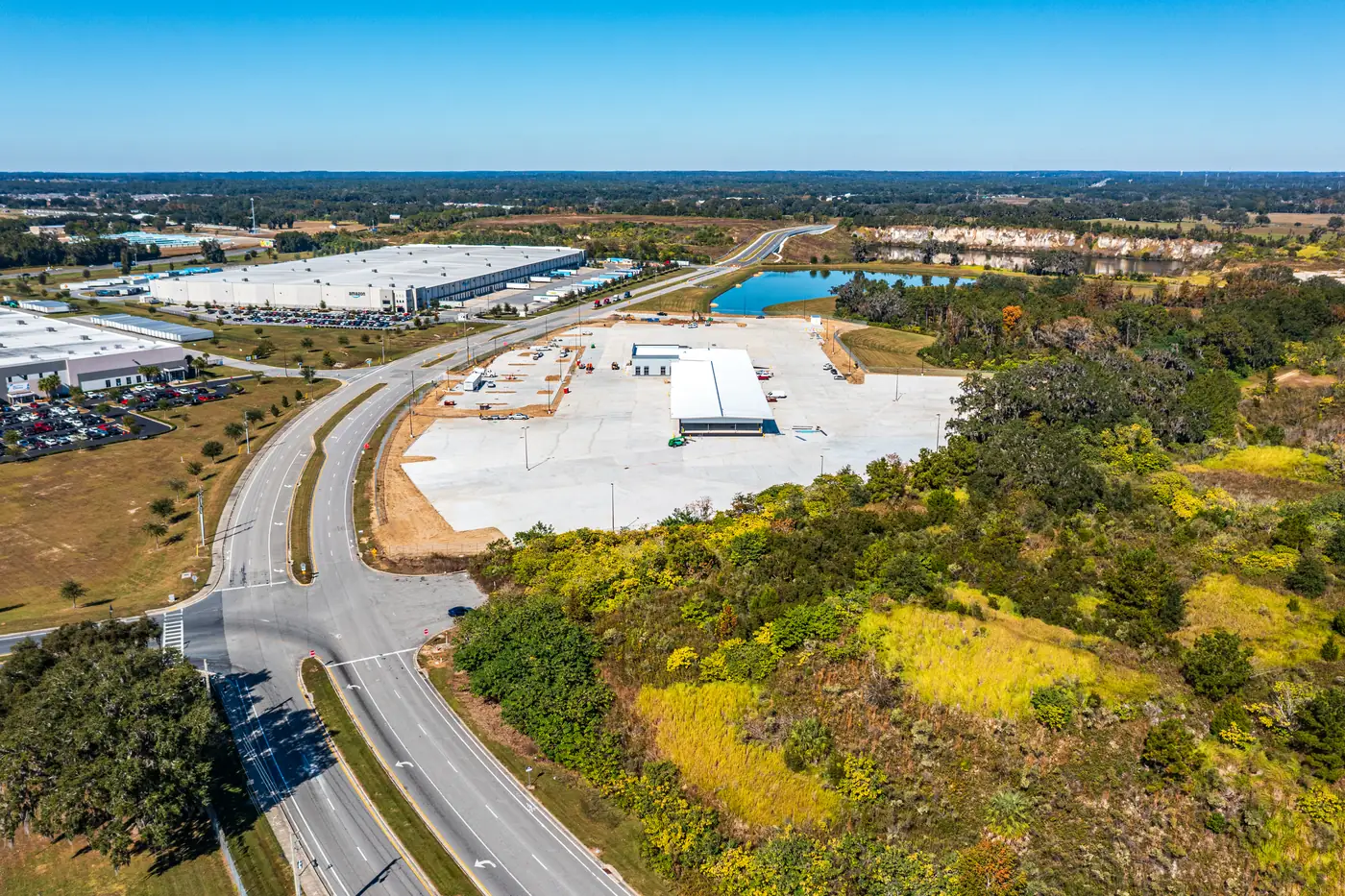
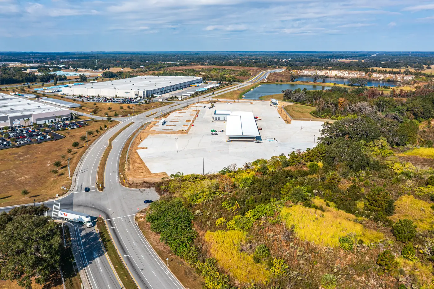
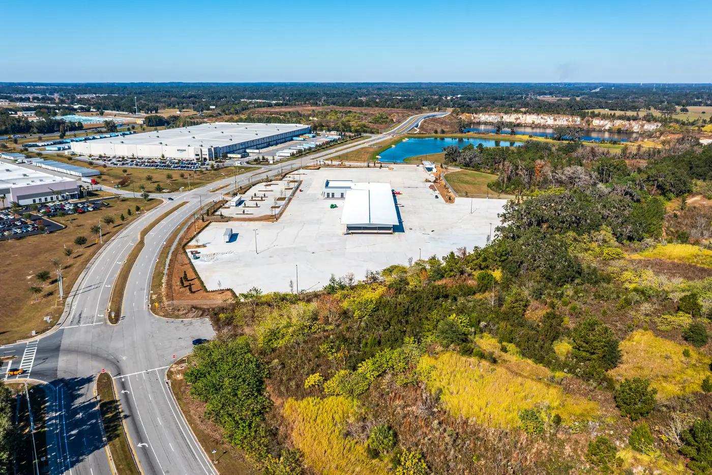
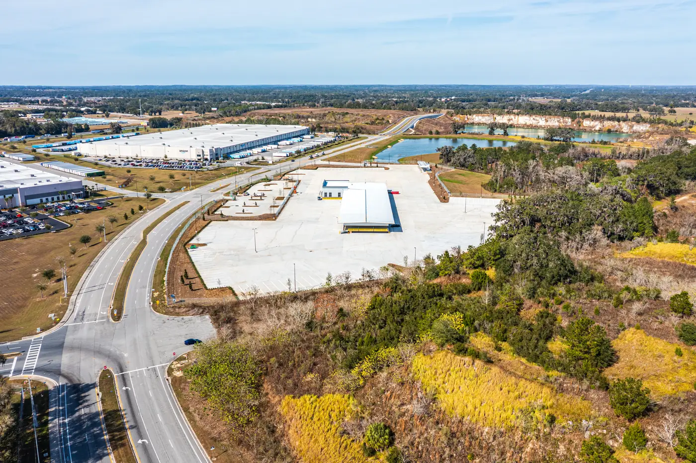
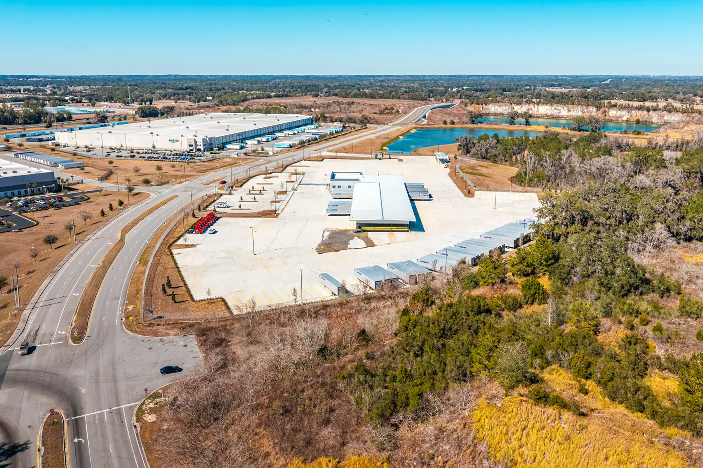
Archive shown from Visit 6 onward (Visit 32 not archived) · all 34 scheduled visits were flown and delivered
From Bare Ground to a
53-Door Cross-Dock Terminal
Sitework, Earthwork & Pad Preparation
Every trucking terminal starts as dirt, and dirt is where documentation matters most. Our early bi-weekly flights captured the clearing, grading, and pad preparation for the service center and its truck yard — the phase where quantities are largest, conditions change fastest, and the visual record disappears under the building. For industrial construction in Marion County, aerial documentation of the sitework phase gives the project team an objective baseline: what was moved, where, and when. Once the slab is down, those answers only exist in the archive.
A Bi-Weekly Photo Record Built
for Reports, Pay Apps & Draw Inspections
A documentation program is judged by what lands in the project team's inbox. Every Averitt visit produced the same deliverable, organized the same way, on the same schedule — which is exactly what makes an archive usable.
High-Resolution Aerial Progress Photos
Each bi-weekly flight captured the full site — the standardized establishing views plus working frames of the active fronts: earthwork, foundations, dock door runs, and yard paving. Every image carries timestamped, geotagged metadata, which is the difference between a photo and evidence. For the owner's rep, that meant report-ready imagery every two weeks; for the project team, an objective record behind every pay application line item.
Organized, On-Schedule Delivery
Photos were delivered in consistently named, visit-numbered sets — so anyone on the team could pull "Visit 18" a year later and know exactly what they were looking at. That structure is what lets an archive answer draw-inspection questions in minutes: find the visit closest to the draw date, open the set, done. The final deliverable added the twilight and night photography of the completed service center — the closing chapter of the record.
The Same Angles,
Every Two Weeks
Recurring drone flights only produce a usable record when every visit is captured the same way. Scroll the timeline above and the proof is on the page: the establishing view matches from Visit 6 to Visit 34.
Standardized Angles & Altitudes
Every flight repeated the same vantage points at the same altitudes, so each photo set is directly comparable to the one before it.
True Progress Comparison
Because the frames align, any two visits can be placed side by side — earthwork to dock doors to finished yard — and the change is self-evident.
Fixed Bi-Weekly Schedule
Flights ran on the calendar, not on convenience. A cadence kept for 34 straight visits is what turns photos into a continuous record.
FAA Part 107 Operations
Certificated pilots, commercial aviation insurance, and airspace authorization handled for every flight near Ocala International Airport (OCF).
Twilight and Night Aerial Photography
for Project Completion
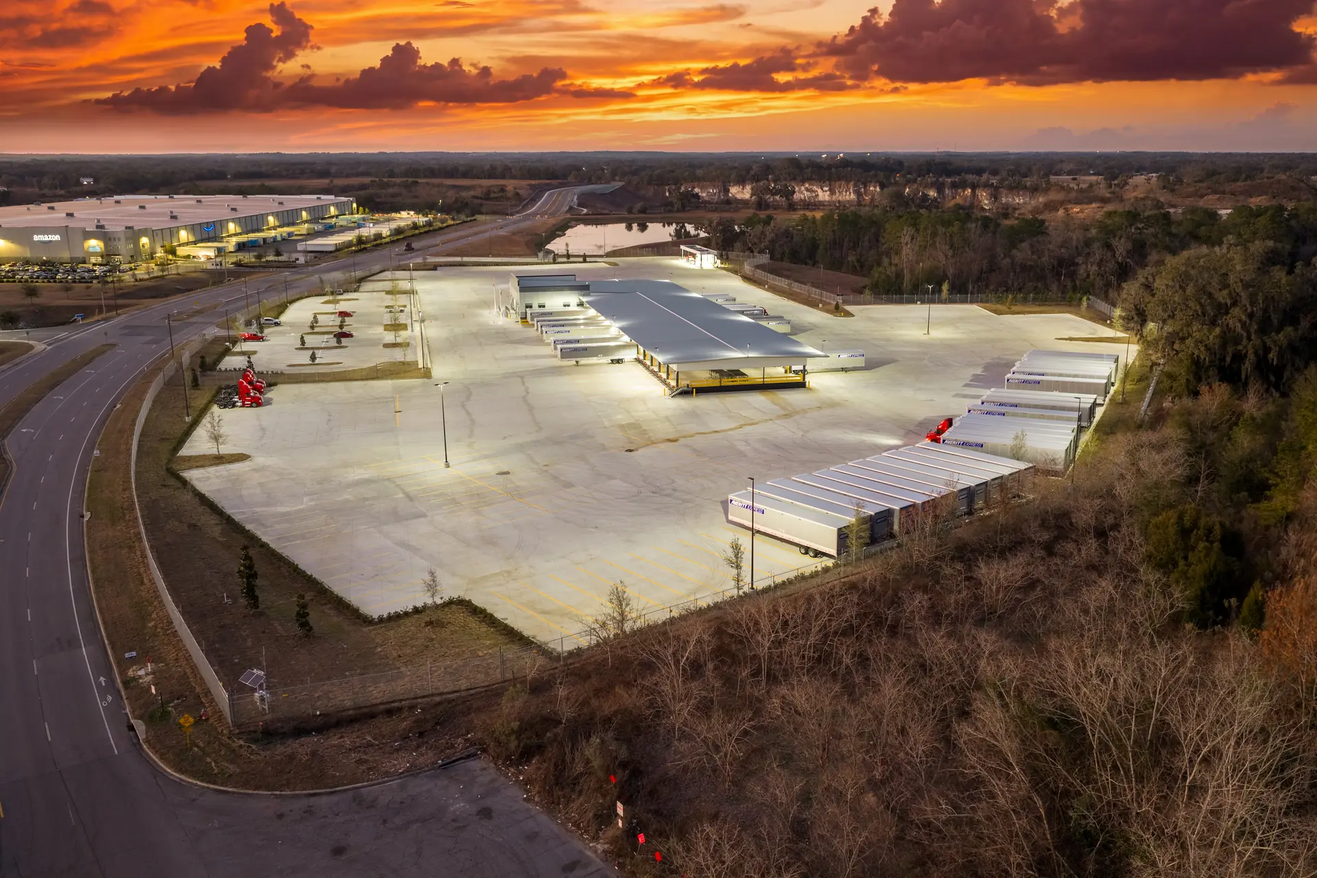
The engagement closed the way every long documentation program should: with imagery worth framing. As the completed service center's dock and yard lighting came on, we captured twilight and night aerial sets of the finished terminal — the definitive completion record for the project team, and the photography Averitt's facility announcements and marketing can draw on. Twilight drone photography of commercial buildings is a niche most operators never touch; it requires precise timing, manual exposure work, and a facility lit for operations.
Twilight Photography
24 images capturedNight Photography
53 images capturedTwilight drone photography of a commercial building is unforgiving work: the usable light lasts minutes, exposures are set manually as the sky falls off, and the facility has to be lit for operations — dock lights, yard poles, signage — before the window opens. Night aerial photography of a completed construction project pushes further still, balancing long exposures against a moving aircraft. The payoff is imagery nothing else on the engagement can match: the 24-frame twilight set and 53-frame night set of the finished Averitt terminal are the photos that end up in completion announcements, marketing, and the owner's permanent record of the build. We offer twilight and night shoots as the closing deliverable on any recurring documentation program.
What Project Managers Get From
34 Consecutive On-Time Visits
A complete archive, first of all — every phase of the build, photographed on schedule, with no gaps for a dispute or a draw question to fall into. Because every flight used the same angles and altitudes, the archive works as a true comparison series: put Visit 10 next to Visit 30 and the progress explains itself. That's what turns drone photos into documentation a PM can attach to progress reports, stakeholder updates, pay applications, and draw inspection packages.
And they get their time back. Nobody on the project team had to follow up with us, reschedule us, or wonder whether the photo set would arrive — for the life of the project the documentation simply showed up. When you hire a drone pilot for construction site progress photos, that's the property to screen for: not the camera, the calendar.
Construction Drone Documentation
FAQ
Match the cadence to how fast the site changes. For an industrial project like a cross-dock service center — where sitework, vertical construction, and yard paving each move on multi-week rhythms — bi-weekly drone flights capture every meaningful milestone without paying for redundant visits. Slower horizontal projects often run monthly; fast vertical projects sometimes justify weekly. The Averitt project ran bi-weekly for the full build: 34 scheduled visits, 34 flown and delivered on time.
Each visit includes a full set of high-resolution aerial progress photos captured from standardized angles and altitudes, delivered on a fixed schedule with timestamped, geotagged metadata intact. Programs are scoped to the project: cadence (weekly, bi-weekly, or monthly), deliverable types (photos, 4K video, mapping), and completion photography such as twilight and night shoots. The consistency is the point — every set is comparable to the last one, so the archive reads as a continuous record rather than a pile of unrelated photos.
Three reasons come up on nearly every project. Progress verification: aerial photos are objective evidence for schedule discussions, pay applications, and draw inspections. Stakeholder communication: owners, lenders, and out-of-town executives can see the full site in one frame without traveling. Documentation insurance: when a question surfaces months later about site conditions or sequencing, the timestamped archive answers it. On a facility as long as a 53-door cross-dock, the aerial frame is also simply the only view that shows the whole building at once.
Yes, when flown by a certificated remote pilot under FAA Part 107 with the client's authorization. Our pilots hold FAA Part 107 certificates, carry commercial aviation liability insurance, and secure LAANC airspace authorization when a site sits in controlled airspace — as parts of Ocala do around Ocala International Airport (OCF). Flights are coordinated with site supervision, and all imagery is delivered to the client, not published without permission. The named-client work you see on this page is shared with approval.
Yes — it's one of the most common reasons PMs put a recurring program in place. Timestamped, geotagged aerial photos tied to a visit schedule give the lender's inspector and the owner's rep objective evidence of what work existed on a given date: earthwork placed, structure erected, paving completed. On the Averitt project, the bi-weekly cadence meant a current photo set was never more than two weeks old when a draw question came up. The archive doesn't replace the inspector — it makes their verification faster and removes the argument from the process.
Twilight and night aerial photography captures a completed facility with its exterior lighting active — dock lighting, yard illumination, and signage. On commercial and industrial projects the set serves double duty: it's the definitive completion record for the owner, and it's the imagery that actually gets used in marketing, leasing, investor decks, and press announcements. We schedule twilight/night shoots as the final visit of a documentation program, once the site is substantially complete — exactly how the Averitt engagement closed.
Services & Case Studies
Set Up Bi-Weekly Drone
Documentation for Your Build
Trucking terminal, distribution center, industrial park, or commercial sitework — if your project needs a documentation vendor who treats the schedule as non-negotiable, we'll build a recurring program around your cadence and deliverable requirements. FAA Part 107 certified, insured, and based in Gainesville.